Fun Trail Facts
Marys Peak is the highest point in the Oregon Coast Range, and is listed as 11th in the state in terms of prominence (vertical distance between summit and lowest contour). The Peak is historically referenced as a sacred location for the Kalapuya Tribe, where spirit quests were conducted.
While I always thought of it as "Mary's Peak," the correct spelling is indeed "Marys Peak." The reason for this is that the United States Board on Geographic Names stopped using possessive apostrophes in place names back in 1890 in order to not show ownership of geographic features. This is not without debate, as referenced in a recent Wall Street Journal article.
While I always thought of it as "Mary's Peak," the correct spelling is indeed "Marys Peak." The reason for this is that the United States Board on Geographic Names stopped using possessive apostrophes in place names back in 1890 in order to not show ownership of geographic features. This is not without debate, as referenced in a recent Wall Street Journal article.
Trail Info
| Hike/Section Name Marys Peak Summit Hike County & State Benton County, Oregon Ecoregion Coast Range | Volcanics Forest Siuslaw National Forest Latitude & Longitude (DEC) 44.5042870, -123.5512165 Family Friendliness For the Summit Hike, this may be one of the family-friendliest hikes with the greatest rewards you'll find (assuming better weather than we got) Hike Difficulty Easy Elevation 4,032 Feet Elevation Gain ~400 Feet Distance ~ 1.5 Miles Route Type Out and Back Access to Trailhead It couldn't be easier; Extremely well-maintained paved road all the way up the mountain that drops you off right at the trailhead. Ample parking. |
Trip Report

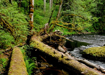
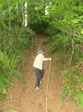
Sometimes you have to bend when you know the odds. Sometimes when the odds are against you, you have to bend. Both scenarios came about today, and I took home some pretty good parenting lessons. I've been planning a big hike up to Marys Peak in the Siuslaw National Forest for nearly a week now. The lad and I were going to trek from Conner's Camp and get to the summit via the East Ridge Trail, Tie Trail, Meadow Edge Trail, and the Summit Trail. Then the weather forecasts started going nuts for the past couple of days. Looks sunny on Sunday according to weather.com, but wunderground.com paints a bleak, wet picture. By the time Saturday night hit, all sources were reporting the latter.
Waking up this morning, I didn't think we'd be going anywhere; It's pretty amazing what small patches of blue in the Oregon skyline does to rational judgement. Gear was hastily packed and I rushed to the store for goodies to feast upon. Getting back home, it was a rush to get boots on and hit the door.
Waking up this morning, I didn't think we'd be going anywhere; It's pretty amazing what small patches of blue in the Oregon skyline does to rational judgement. Gear was hastily packed and I rushed to the store for goodies to feast upon. Getting back home, it was a rush to get boots on and hit the door.
And then something happened that struck me wickedly hard, but in the best of ways; For one of the first times ever, the boy did not complain once about leaving. He was more excited than I was! No whining? To be fair, his usual gripes disappear the second we're in the car. That noted, the absence of whining was just leaving me dizzy and confused. Shaking it off, we hit the road southward for Marys Peak.
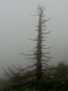
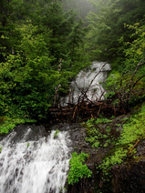
Rain and sunshine kept swapping scenes during the drive, giving me hope we would have at least some views at the summit and relative dryness under the canopy when we hit the trail. When we got closer to Corvallis (itself wonderfully dry and sunny), I abandoned all hope when I saw our destination shrouded in dark clouds, a fog mound without the mound. I knew we were playing against the house, but it looked like the weatherman was showing a Queen and we had 16.
Rain and sunshine kept swapping scenes during the drive, giving me hope we would have at least some views at the summit and relative dryness under the canopy when we hit the trail. When we got closer to Corvallis (itself wonderfully dry and sunny), I abandoned all hope when I saw our destination shrouded in dark clouds, a fog mound without the mound. I knew we were playing against the house, but it looked like the weatherman was showing a Queen and we had 16.
I looked back at the contented boy in the car seat behind me, and then saw myself in the rear-view mirror debating whether or not we should keep driving. The boy doesn't complain at all and is super excited to go hiking, but I'm taking him directly into a den of rain and cold. That has never worked out well, and I'm amazed that our coldest and wettest hike through Salmon Creek didn't extinguish any and all desires of his to be outdoors. Do we stick with the original plan? Shave off a leg or three of the hike? Grab a hot cocoa and call it a day? Maybe it will all disappear once we get up there? Of course, storm winds capable of magically arriving and doing that trick would be a blast to hang out in.
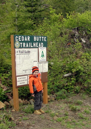
I stopped with the inner dialogue and brought the lad into the fold. I think I'm still getting used to the fact that he is as sharp as he is, and that ownership in these decisions is important for him as well. He wanted to continue, so ahead we went. Driving up the turnoff from the highway toward the Coast, we made our ascent up Marys Peak and into the clouds. All of my plans of starting down the mountain dwindled and we drove up to the campground so that we could hit the Meadow Edge Trail. Upon getting out of the car to go pay our five bucks for the day-use fee, the boy's demeanor went south quickly. Even bundled up, the saturation of mist and bone-chilling wind were too much for him.
I stopped with the inner dialogue and brought the lad into the fold. I think I'm still getting used to the fact that he is as sharp as he is, and that ownership in these decisions is important for him as well. He wanted to continue, so ahead we went. Driving up the turnoff from the highway toward the Coast, we made our ascent up Marys Peak and into the clouds. All of my plans of starting down the mountain dwindled and we drove up to the campground so that we could hit the Meadow Edge Trail. Upon getting out of the car to go pay our five bucks for the day-use fee, the boy's demeanor went south quickly. Even bundled up, the saturation of mist and bone-chilling wind were too much for him.
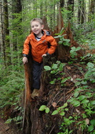
He was so excited an hour ago...
It was executive decision time. Make him rough-it, or acquiesce? I put him back in the car and we drove up to the viewpoint. We got out, paid our fee, and the excitement of seeing some snow on the ground overcame anything else that was bringing him down. Some quick snowballs later, we were on our way up to the top.
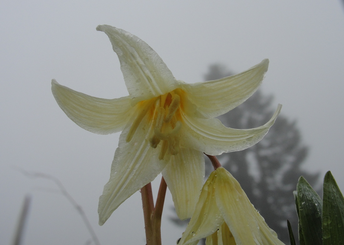
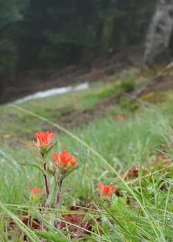
WIth avalanche lilies, Indian paintbrush, field chickweed, and penstemon popping up along the hike, we had a great time pointing out the different colors. It was a welcome distraction from the cold wind that came and went. Moving up the short hike and passing the other trails we were destined to take before the climate intervened, I had a chance to embrace that he was having a good time despite the weather. Had I pushed him, I can say that this would not have been the case. Score one for parenting.
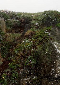
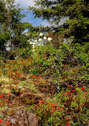
After passing a couple of folks on their way down, we finally made it to the infamous rock garden near the summit, a lithosolic (weathered rock fragments on steep slopes) community that is on the south-southwestern side of the top. The explosion of flowers in this barren little area is jaw-dropping, especially considering that the area is surrounded by snow above and below.
It was executive decision time. Make him rough-it, or acquiesce? I put him back in the car and we drove up to the viewpoint. We got out, paid our fee, and the excitement of seeing some snow on the ground overcame anything else that was bringing him down. Some quick snowballs later, we were on our way up to the top.
WIth avalanche lilies, Indian paintbrush, field chickweed, and penstemon popping up along the hike, we had a great time pointing out the different colors. It was a welcome distraction from the cold wind that came and went. Moving up the short hike and passing the other trails we were destined to take before the climate intervened, I had a chance to embrace that he was having a good time despite the weather. Had I pushed him, I can say that this would not have been the case. Score one for parenting.
After passing a couple of folks on their way down, we finally made it to the infamous rock garden near the summit, a lithosolic (weathered rock fragments on steep slopes) community that is on the south-southwestern side of the top. The explosion of flowers in this barren little area is jaw-dropping, especially considering that the area is surrounded by snow above and below.
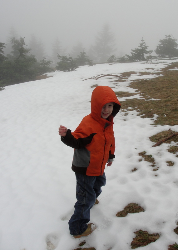
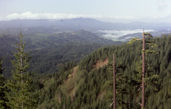
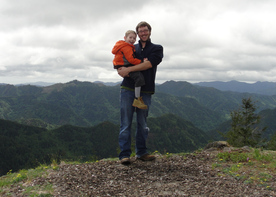
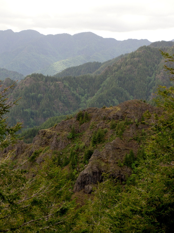
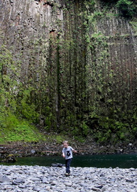
A few hundred yards later, we were at the summit of the highest point in the Oregon Coast Range. While awesome, our visibility was limited to about 200 feet. Furthermore, the summit offered no protections against the wind. While we could have just turned around, the boy channeled up some desire and asked to go further, especially when he saw a huge patch of snow. We cruised down from the summit and slid around in the snow for a spell. It was a blast, and when he said he was ready to go, I was kind of thrilled because my nippy hands and ears were telling me the same.
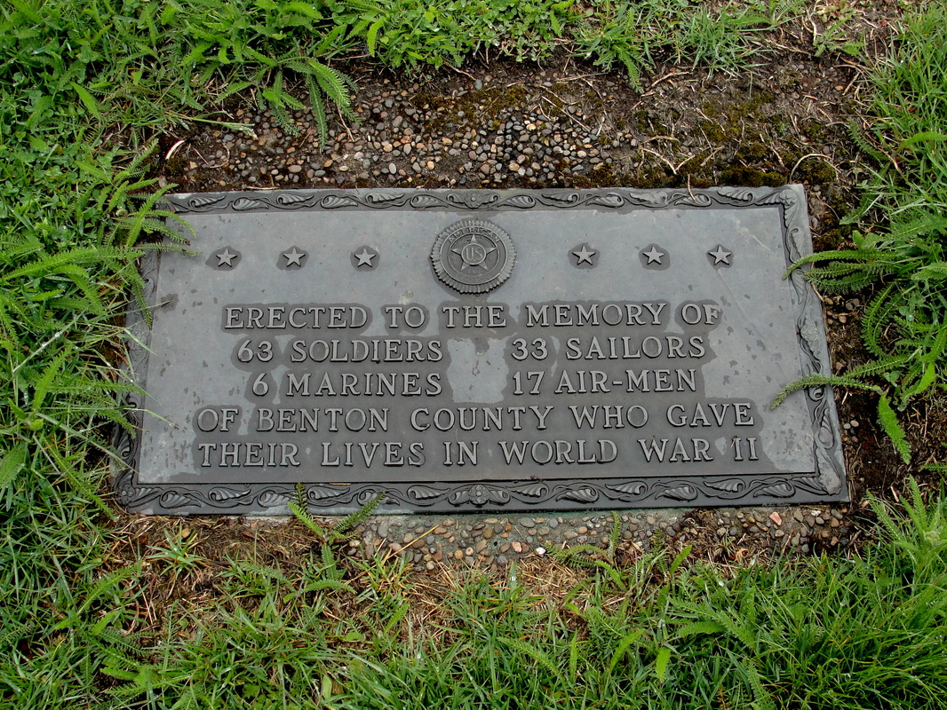
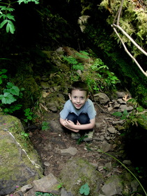
A quick jaunt down the trail, and we were back through the meadows and at the observation area parking lot. Before going all the way back to the car, a quick turn was taken and we arrived at a plaque memorializing the Benton County veterans of World War II who never made it home. That was a perfect opportunity to tie in the importance of Memorial Day with my son, and I'm thankful it turned out just as it did.
A quick jaunt down the trail, and we were back through the meadows and at the observation area parking lot. Before going all the way back to the car, a quick turn was taken and we arrived at a plaque memorializing the Benton County veterans of World War II who never made it home. That was a perfect opportunity to tie in the importance of Memorial Day with my son, and I'm thankful it turned out just as it did.
Back in the car with the heater on, I had a very happy little hiker on my hands. Despite every desire I had to push forward with bigger and better hikes on a day full of rotten weather, I am fully behind the decisions to include him on the eventuality of our plans and to fold things up the way we did. Marys Peak will be there next week, or next month, or next year, and I want a happy lad to enjoy it as much as possible given any conditions.
Today was the perfect balance achieved by a little bending from both of us, and not an ounce of real complaining.
I think I beat the house this time.
Today was the perfect balance achieved by a little bending from both of us, and not an ounce of real complaining.
I think I beat the house this time.
More Information
Marys Peak Scenic Botanical Area (Oregon Plants, Oregon Places)
- A great read! History, geology, and botany, oh my!
Portland Hikers Field Guide - Marys Peak Summit Hike
Wildflowers of Marys Peak Meadows, a Pocket Guide
Peakbagger.com - Marys Peak, Oregon
- A great read! History, geology, and botany, oh my!
Portland Hikers Field Guide - Marys Peak Summit Hike
Wildflowers of Marys Peak Meadows, a Pocket Guide
Peakbagger.com - Marys Peak, Oregon

 RSS Feed
