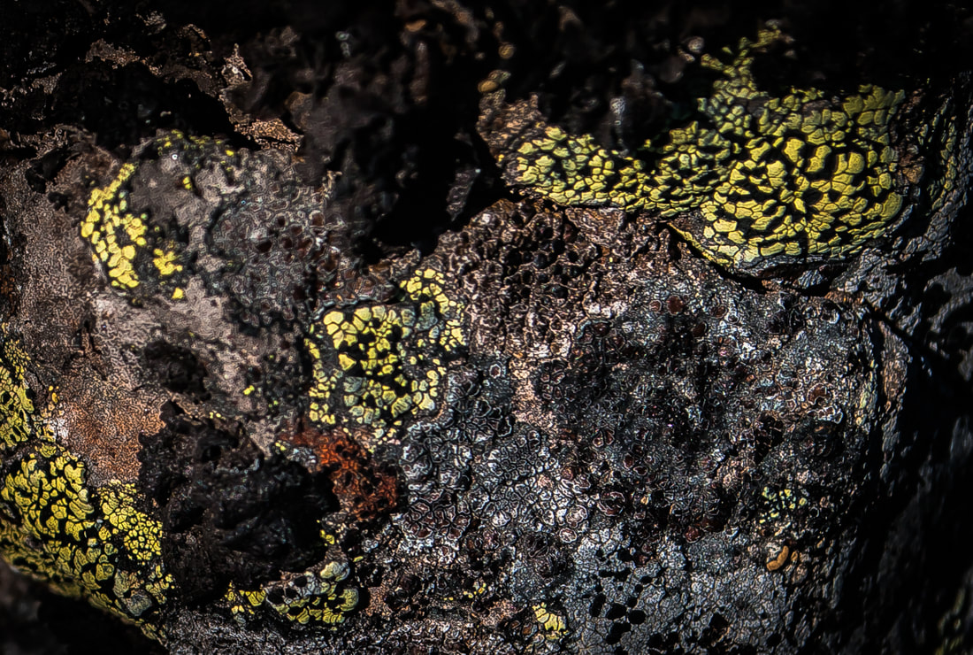
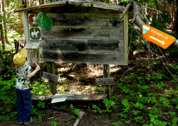
Trail Dad - PNW Hikes
  • Home
  • Trip Reports
  • Our Hike Map
  • Outdoor Hacks - Camping | Hiking
  • GIS & Randomness

Mount Lowe

7/23/2017

2 Comments

 
Picture

​Fun Trail Facts

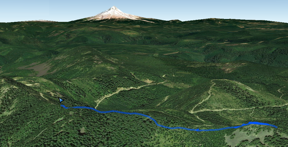
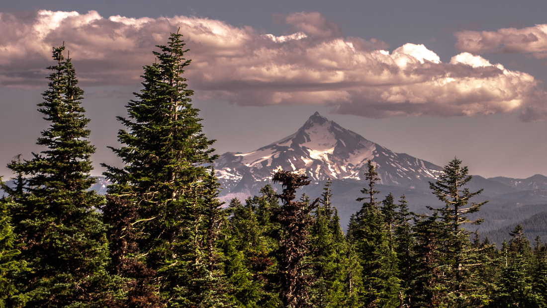
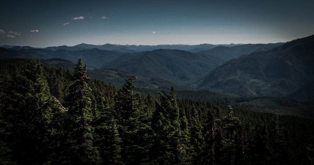
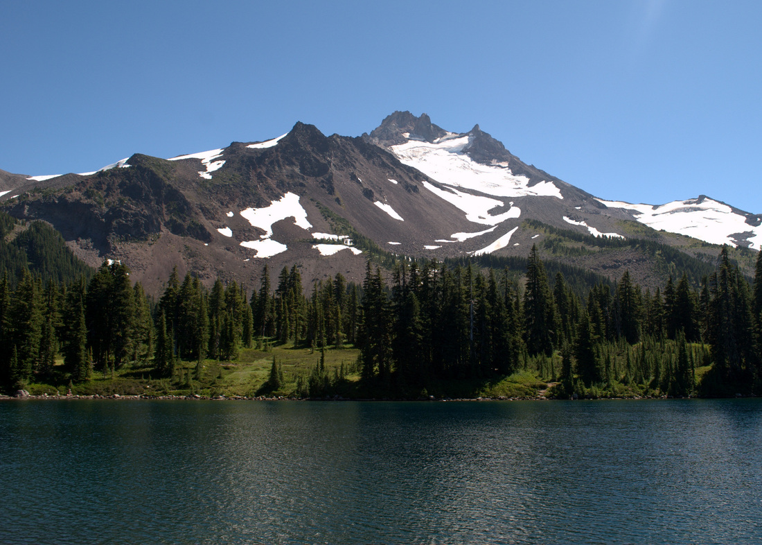
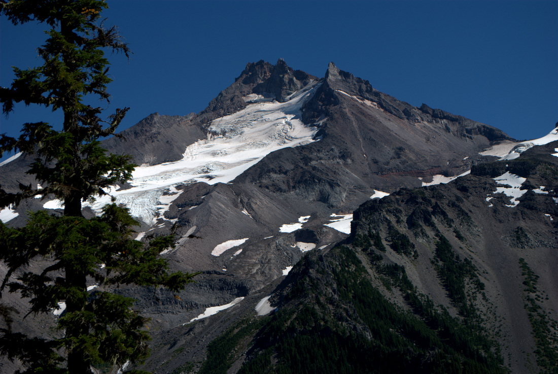
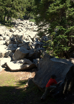
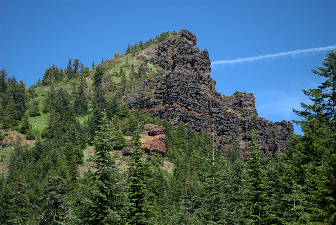
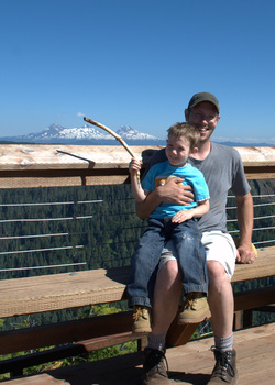
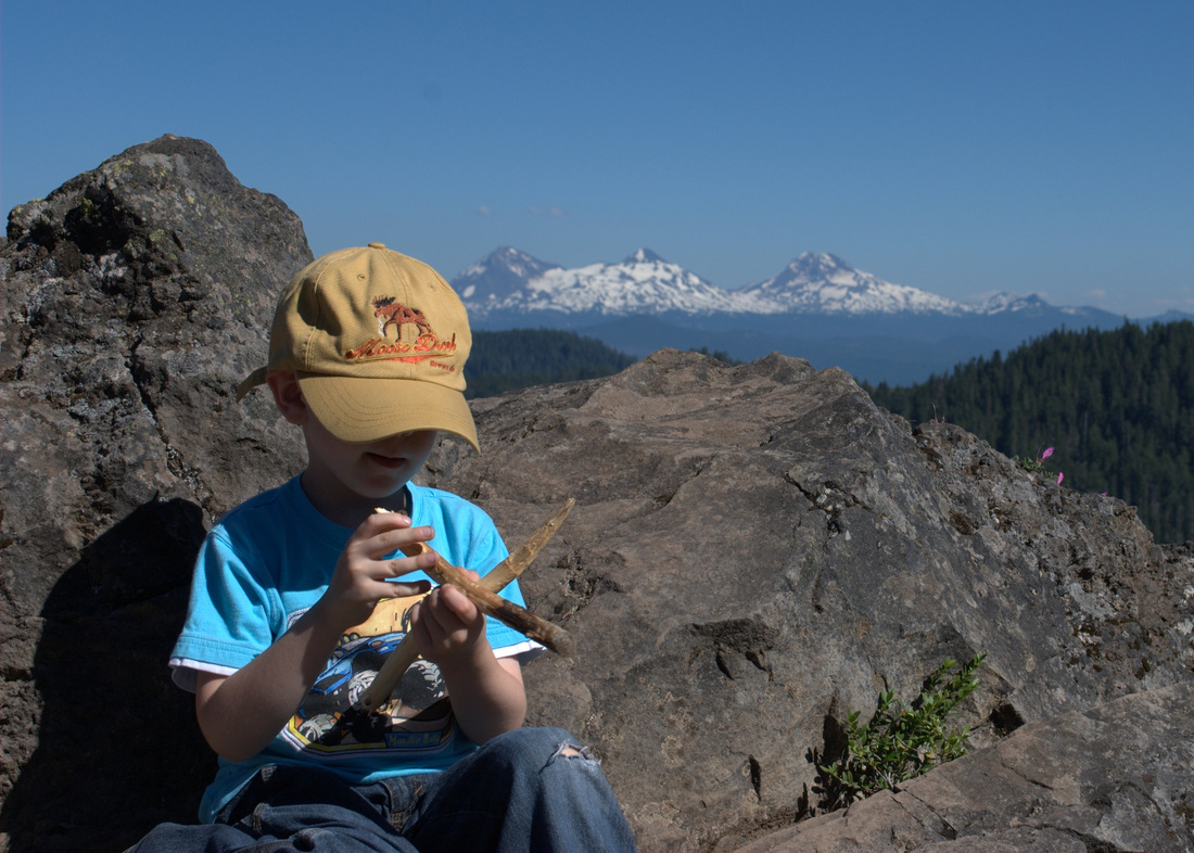
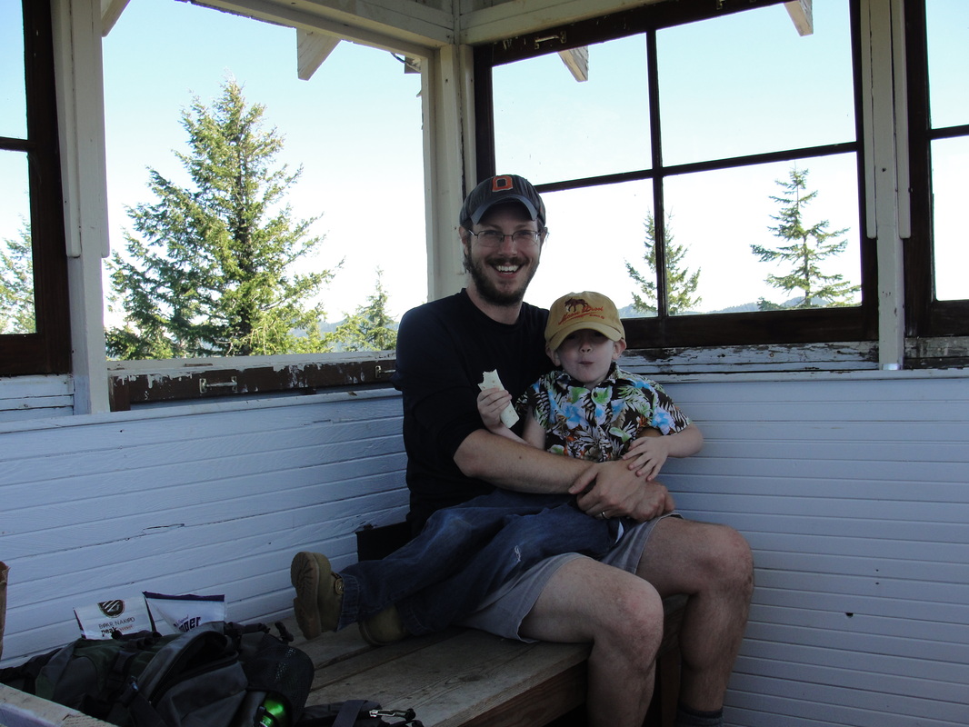
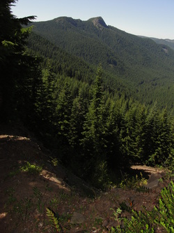
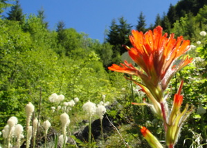
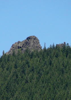
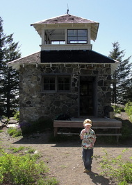
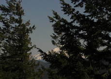
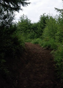
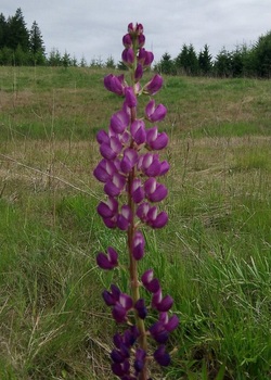
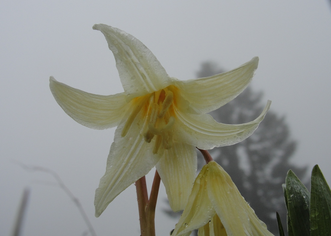
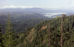
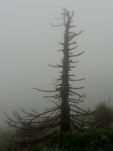
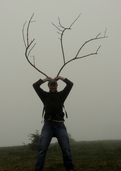
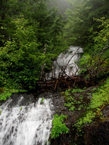
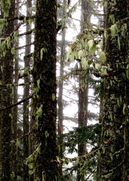
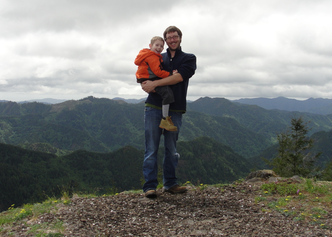
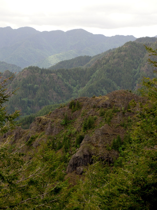
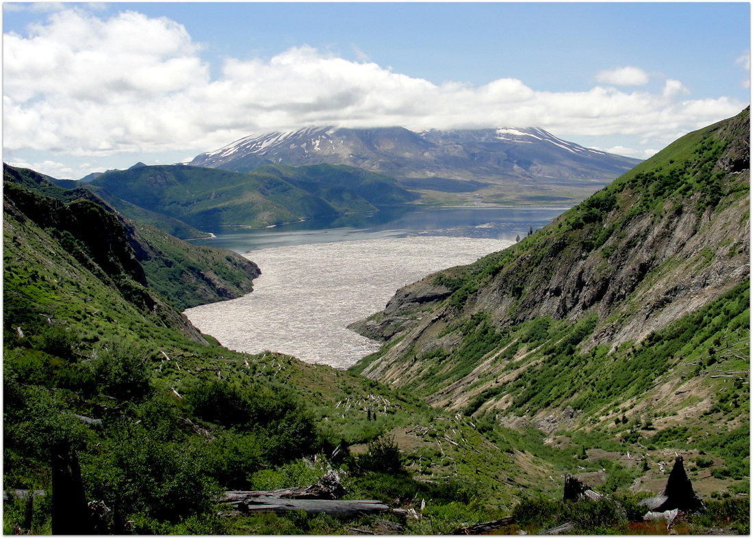
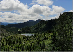
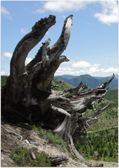
Mount Lowe is the site of a former fire lookout with great views of the Oregon Cascades. It sits on the northern end of the Rhododendron (Rho) Ridge Trail #564. This trail is part of the old Skyline Trail, Oregon's precursor to the Pacific Crest Trail.

Trail Information

Hike Name
Mount Lowe Hike
County & State
Clackamas County, Oregon
Forest
Mt. Hood National Forest
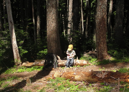
Family Friendliness
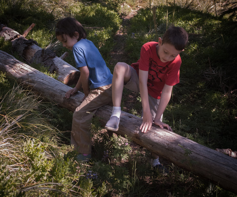
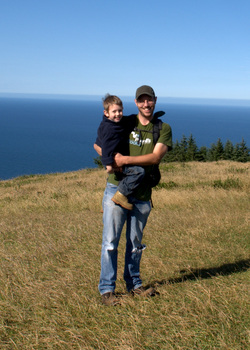
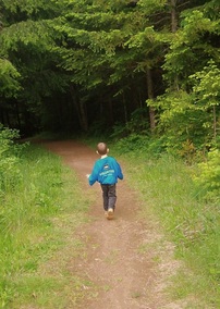
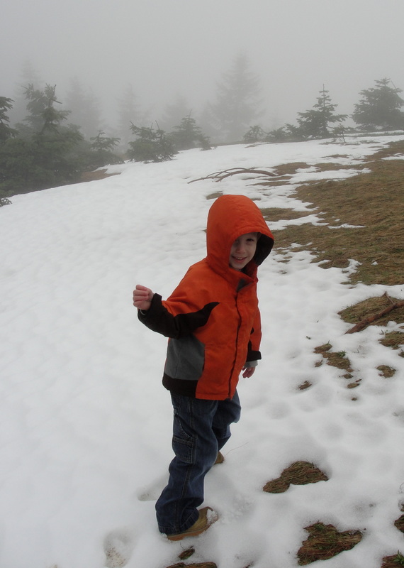
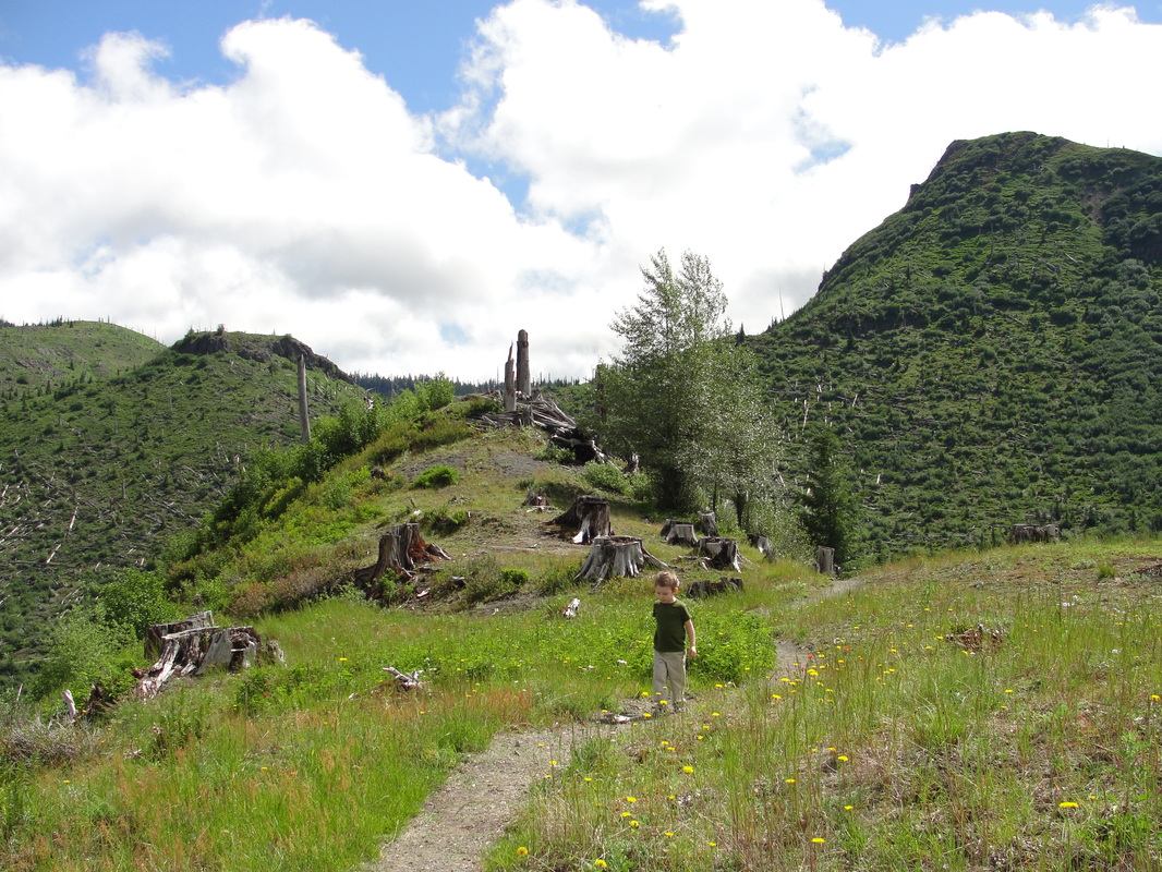
Definitely a good jaunt for little ones as long as you stick to the Mount Lowe Hike or the beginnings of the Rho Ridge Traverse Hike.
Hike Difficulty
Easy
Elevation Gain
665 feet
Distance
3.0 miles
Route Type
Out and Back
Access to Trailhead(s)
Follow Hwy 224 south from Estacada for 43 miles to the 4670 forest road. After 8 miles, you can go for the longer hike by taking a right on the 6310 forest road and going one more mile to a saddle in the ridge and park on the right in a pullout. A jeep road is immediately behind and the trailhead is 0.1 miles up that direction.    
Another option (much shorter hike):
Instead of turning right on 6310, keep going on 4670 and cut right on a hairpin turn as you travel below Mount Lowe. This road continues up and provides a little parking area that is a very quick jaunt from a sign indicating Rho Ridge Trail #564 and is only about .25 miles from the top of Mount Lowe. 
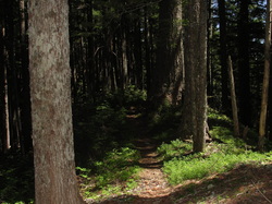
2 Comments

Whitewater Trail to Jefferson Park

8/17/2013

0 Comments

 
Picture
Mount Jefferson looking down on Scout Lake

Fun Trail Facts

Picture
During the last few centuries, several small lakes were formed on the flanks of Mount Jefferson when small tributary valleys became dammed by glacial moraines (ridges of sediment left behind by glaciers). Several of these moraines have breached during the 20th century, producing local floods and small lahars.


From: Walder, et.al., 1999, Volcano Hazards in the Mount Jefferson Region, Oregon: USGS Open-File Report 99-24

How amazing is it that the gorgeously flat areas of Jefferson Park and the lakes therein are largely the work of glacial flooding!?

Trail Information

Picture
A little marriage between passions - hiking and GIS
Hike Name
Whitewater Trail to Jefferson Park
County & State
Marion County, Oregon
Ecoregion
Cascades | Cascade Crest Montane Forest & Cascade Subalpine/Alpine
Forest
Willamette National Forest
Latitude & Longitude (DEC)
44.709841, -121.812846
Family Friendliness
Keeping in mind that this is a pretty grueling day hike, it was actually a pretty phenomenal one to have my 4-yo son along with me. The stretch along the edge of the Sentinel Hills has some drops on the right side that kept the lad close to me, but most of the hike is a gentle climb without much to be concerned about. On a Saturday in August, this trail was packed early in the morning and cleared out by late afternoon. 
Hike Difficulty
Difficult
Elevation
At Jefferson Park, 5,902 feet
Elevation Gain
1,800 feet
Distance
11.0 miles round trip from the Whitewater Trailhead to the Scout Lake. We went up and around the lakes a couple of times and ended up clocking about 15 miles.
Route Type
Out and back
Access to Trailhead
Access to the Whitewater Trailhead is pretty dang easy, accessible right of of North Santiam Highway 22, 10 miles past Detroit. The only caveat is that the first mile or so of the gravel road off of the highway has some major potholes. See here.
Fee
Northwest Forest Pass

Trip Report

The hike from Whitewater Trailhead up to Jefferson Park through the Sentinel Hills is nothing short of amazing. It's a gorgeous, gentle climb on a very maintained trail that takes you from some pretty dense forest all the way to the subalpine ecoregion on the north side of Mount Jefferson. That said, it is lengthy, and after carrying the lad for about 3/4 of the entire way, I really understood why so many folks were backpacking along the banks of Scout Lake, Bays Lake, and Rock Lake!

With a lovely day in front of us, Trail-Son and I hoofed it many miles, flirting with Mount Jefferson the entire way. Along every single turn of the trail, that lovely mountain was right there saying hello. Mount Jefferson and Three Fingered Jack are the lad's favorite mountains, so it was really amazing to watch him "interact" with one of the two in such a close proximity. At one point, we could hear the water flow coming off of the area around the Jefferson Park Glacier, and I could have sworn the lad was having a full conversation with the mountain in response.

In another really awesome turn of events, the wee one has officially hiked part of the Pacific Crest Trail (~ 1% of the Oregon stretch)!

I learned the hard way on this trip that the few pounds that he has packed on this summer makes all of the difference with regard to carrying him up on my shoulders when he gets worn out. Granted, 15 miles will do that to you, but I hit Craigslist the next day and procured an amazing Kelty Kids FC 3.0 carrier from an awesome family that had put it through its paces in the Sierra Nevada. While the boy will get to use it for (maybe) the next year, it will definitely be ready for Trail-Daughter next summer and give my poor shoulders a bit of relief.

I could write about every step of this beautiful trail, but I'm just going to let a few pictures tell the tale. If you're up for a little bit of a crowd and either a long day hike or a really reasonable backpacking destination, this may be one of the best choices I've run across.
Picture
Hanging out among the scree (and pikas)
Picture
The lad's first foray onto the Pacific Crest Trail, complete with a marshmallow celebration.
Picture
Taking some time to cool off in Scout Lake
Picture
What an awesome day!

More Information

Picture
Willamette National Forest - Mt. Jefferson - Jefferson Park Trail Area (Forest Service)

Jefferson Park from Whitewater Trailhead Hike (Portland Hikers Field Guide)

Oregon Hikes - Jefferson Park (Oregon.com/William Sullivan)

Jefferson Park and Park Butte (Loomis Adventures)

Jefferson Park Trail - AllTrails.com

0 Comments

Cascade Head - Nature Conservancy Trail

7/15/2013

0 Comments

 
Picture

Fun Trail Facts

Picture
Cascade Head was protected from development in the early 1960's, and by 1966, volunteers had raise enough money to purchase the property and transfer it to the Natural Conservancy.

Not only is Cascade Head Preserve a National Scenic Research Area, but it is also considered a United Nations Biosphere Reserve.

There are some extremely rare organisms that call Cascade Head home. On the plant side, the rare hairy checkermallow and 99% of the world's population of Cascade Head catchfly live here. The threatened Oregon silverspot butterfly finds nourishment for its larvae in the early blue violets that frequent the area, and may be seen fluttering around.

The area is a beautiful combination of different environments, including an estuary (Salmon River), river system, ocean edge, and higher elevation headland and forest.


Trail Information

Hike Name
Cascade Head Nature Conservancy Trail, Lower to Upper Trailhead and Back Again
County & State
Tillamook County, Oregon
Ecoregion
Oregon Coast Range | Coastal Uplands
Forest
Willamette National Forest
Latitude & Longitude (DEC)
45.0567729-124.0048364
Family Friendliness
For the most part, I was very comfortable having my 4-y.o. son with me on this hike. That said, the cliffs at the top are not very far from the trail and they mean business! We're talking hundreds of feet down, and a straight drop at that. The length was a bit rough, and the trail itself is very thin at times with vertically cut edges that can be rough on little legs. These latter concerns would be easily remedied by doing the shorter 1-mile hike from the upper trailhead.
Hike Difficulty
Moderate
Elevation
At the height of the trail, ~ 1,345 feet
Elevation Gain
1,200 feet
Distance
8.4 miles round trip from Knight Park to the Upper Trailhead near Hart's Cove Trail
Route Type
Out and back
Access to Trailhead
Access to Knight Park, site of the lower trailhead, is amazingly easy. There are no dirt or gravel roads to traverse, and it is located just minutes off of Highway 101. See here.
Fee
None. However, there are a couple of donation boxes that help the folks at the Nature Conservancy maintain this place of beauty (hint, hint).
Hiking Notes
This area is so ecologically sensitive, it is really important to stay on the trail and not bring pets.
Picture

Trip Report

Picture
My son and I left our house at four in the morning, and his chipper demeanor at such an ungodly hour of being woken up surprised me to no end. While I was struggling to make coffee for the drive, he was bright-eyed and getting dressed. In short order, we were loading the car up and heading toward the Oregon Coast surrounded in darkness.

By the time we reached Knight Park, the sun had just started showing itself, bathing everything in a beautiful glow. We made our way throughout the initial hiking trails, listening to hundreds of birds chattering away. The trail dives a bit into plantation forest, popping up again for a little roadside hugging, and then begins the uphill descent at what appeared to be the original trailhead.

Picture
Before much longer, we were feasting on salmonberries and stalking flowers with the camera. The floral varieties were absolutely amazing, and more pictures of them may be found here.

One of the lessons I have solidly acquired during the past couple of years of hiking with my son is that you must always be prepared for ten-, twenty-, or thirty-minute intermissions when a new critter is found. On this hike, he spent the better part of that time observing (and gently petting) a millipede that was crossing the trail. There are fewer things in the world more peaceful than watching his eyes light up with amazement during such bouts of curiosity.

The trail through the forest was heavily root-laden, so do consider your ankles when making your way through the area. There are several very recent-looking bridges that cross streams during this section of the hike.

Upon breaking free of the Sitka hemlock, Douglas-fir, and red alder, we came upon our first major ocean views and the absolutely stunning prairie headlands. The trail here is rather thin with some deeply cut edging, so again, keep those ankles safe!

Picture
After making our way through several switchbacks, we found ourselves near the summit of the prairie. Nearby cliffs showcase the beauty of the shore below, but the posted warnings are absolutely worthwhile. With gusts of wind periodically kicking up, I can't imagine anyone being of sound mind that would stand close to those edges. I held onto the boy more tightly than usual as we passed the area.

In an interesting twist, we met our first hiker on the trail at this point. He was a really nice guy, who was admiring the boy's appearance out there. Then he dropped the bombshell on us that he has made the hike over 1,600 times! We joked about him knowing every Oregon silver spot butterfly by name, and then went our merry way.

Past the prairie summit and along the north side of the ridge, the trail is immediately swallowed up in forest. Hiking along what seems to be an old road, we made our way through the cool trees and had another ample opportunity to gorge on salmonberries. Within a mile or so, we found ourselves at the Upper trailhead. Signs were posted that no further exploration was allowed until after July 15th, which put us a few days out. We will definitely be back that way to explore Hart's Cove!

I hoisted the boy upon my shoulders and we returned from whence we came. I was absolutely amazed that he was able to hike four miles during this trek, and all of them the uphill portion. I thought that I would surely be carrying him for at least 5 or 6 miles of the hike, but his tenacity broke my assumption. On the way down, we took a few more pictures and spent some extra time gazing out at the ocean as we nibbled on some snacks.

By the time we got back to Knight Park, the masses were descending on the trail. I can't exclaim how happy I was that we got out there at the time we did. It was cool and isolated, allowing us to block the trail to watch millipedes march or garter snakes slither into the grass.

Cascade Head truly is a beautiful place, and reading about the ecosystems and research that comes from the area only heightens my appreciation. The next time I see thinned forests or read about estuary health for anadromous fish, I will be thinking of the natural beauty and science that occurs in that magical area.

More Information

Picture
Cascade Head Preserve in Oregon | The Nature Conservancy

Cascade Head Hike | Portland Hikers

Cascade Head | Wikipedia

Cascade Head Scenic Research Area | Siuslaw National Forest

Cascade Head Experimental Forest | US Forest Service

0 Comments

Iron Mountain

7/6/2013

3 Comments

 
Picture

Fun Trail Facts

Picture
Iron Mountain is 30 million years older than its towering neighbors to the East, and this maturity definitely shows in the varied habitats one encounters hiking to the top. A pamphlet at the trailhead mentions that Iron Mountain is home to 18 different plant communities, ranging from rock, meadow, forest, and water.

The region is often touted as hosting more than 300 species of flowers during the first part of July. 

Trail Info

Hike Name
Iron Mountain Trail #3389
County & State
Linn County, Oregon
Ecoregion
Cascades | Western Cascades Montane Highlands
Forest
Willamette National Forest
Latitude & Longitude (DEC)
44.4009571, -122.1509036
Family Friendliness
With the exception of the cliffs along Iron Mountain's peak, this is one of the friendliest hikes we have been on all season. That said, still one that necessitates a grand amount of hand holding as the elevation gains.
Hike Difficulty
Moderate
Elevation
5,157 feet
Elevation Gain
800 feet
Distance
2.4 miles round trip
Route Type
Out and back
Access to Trailhead
Really easy to reach the upper trailhead, with just a couple of miles of decently worn gravel road going uphill after turning past mile marker 62 on Hwy 20. Multiple trail heads exist depending on what you want to accomplish (Cone Peak Trail; Santiam Wagon Road). See here.
Fee
Northwest Forest Pass

Trip Report

Picture
The claims of 300 species of flowers showing off their wares during the first part of July are no exaggeration. The lad and I lost count at about fifty!

We had big plans a week ago to do some major camping near Iron Mountain, but untimely car troubles (are there any other kind?) sunk that prospect. With some new wheels to get us from Point A to Point B, it was time to initiate the new vehicle with a good trek to the Willamette National Forest.

The trailhead was hopping when we arrived, and excitingly, it was loaded with little hikers. I can't remember the last time I saw so many little legs coming and going on the trail! 

Informative brochures await at the trailhead, as do some pretty great maps of all the hiking trails that intersect Iron Mountain. Major kudos to the Sweet Home Rangers for hooking us up with such material. 

We were running a bit late that day, so we had opted for the shortest hike straight from the Iron Mountain trailhead, but trust me, the lengthier Cone Peak Trail is on the agenda for another time.

Picture
Before departing the trailhead, I asked the boy if he needed to use the facilities. He replied with a negative, and we started uphill. In a moment of parenting truism, he told me that he did indeed need to use the restroom about 300 yards later. 

The U-turn provided some great opportunities to deeply breathe in the blooming beargrass, and when asked why he couldn't just go potty in the woods, I was able to take the moment and explain what a sensitive area was and why stomping through it unnecessarily was never a good idea.

Upon hitting the trail again, we started upward. I am consistently becoming surprised at how strong the little guy is getting; He managed to do the entire trek upward on his own, passing otherwise fit-looking adults who were winded at times. Having a four-year-old cruise past you was sufficient motivation for those couple of folks to keep going!

After a while, the terrain really opens up as you move out of the forest and into the rocky meadows. Every few feet of elevation brought forth more and more floral surprises. The colors, the scents, the butterflies and bees. Combined with switchbacks that framed Mount Jefferson and the Three Sisters, and you  truly have one of the most beautiful spots in Oregon.

Picture
At the summit, an absolutely gorgeous viewing platform awaits, where you can take a rest, grab a bite, and count the peaks all around you. There is even an informative display that points out every hill and mountain viewable from up there.

While eating lunch, the boy and I had a chance to go through some of our pictures and identify flowers based on the informational brochure we picked up at the trailhead:

Baldhip Rose blossom (Rosa gymnocarpa)
Wooly Sunflower (Eriophyllum lanatum)
Oregon, Creamy, and Spreading Stonecrops (Sedum oreganum, oregonense, & divergens)
Scarlet Gilia (Ipomopsis aggregata)
Blue Mountain Larkspur (Delphinium depauperatum)
Crimson columbine (Aquilegia formosa)
Beargrass (Xerophyllux tenax)

This was only a fraction of our pictures, and we still have a lot of identification to perform! 

I played porter for the trip down, with the lad on my shoulders the whole way down. 

In moments that melted my heart (and those of some folks coming up the trail), he was singing an impromptu hiking song all about going the right way or the wrong way when you come to a fork in the trail. It was tough to beat the beauty of the botanical masterpieces all around, but I think he pulled it off.

More Information

Picture
Iron Mountain Trail @ Forest Service

Iron Mountain Hike @ Portland Hikers

Iron Mountain Wildflowers

Wildflowers of the Western Cascades by Robert Ross (Timber Press, 1988)


Picture
3 Comments

Pechuck Lookout

6/9/2013

1 Comment

 
Picture

Fun Trail Facts

Picture
Pechuck Lookout, a historic two-story cupola fire lookout, is listed on the National Historic Lookout Register (actually the second lookout to receive the honor). The lookout, one of the last stone cupolas in the Northwest, was built in 1918 and last staffed in 1964. 

Volunteers, the Pechuck Look Outs in Molalla, have done amazing work with the BLM to keep this amazing lookout cared for so that it remains accessible to hikers and backpackers. Nestled in the lovely Table Rock Wilderness (6,028 acres) of the Old Cascades, the lookout is available for overnight stays on a first-come, first-serve basis.

Trail Info

Park/Hike/Section Name
Pechuck Lookout via Rooster Rock Road Trailhead
County & State
Clackamas County, Oregon
Ecoregion(s)
Cascades | Western Cascades Montane Highlands
Forest
Table Rock Wilderness (Part of the BLM's National Wilderness System)
Latitude & Longitude (DEC)
44.9342886, -122.2978583
Family Friendliness
Let's just say I either held the lad's hand or had him on my shoulders for 90% of the hike. There are a few spots that are incredibly steep and nervous-making, especially at the summit.
Hike Difficulty
Difficult
Elevation
4,222 feet
Elevation Gain
1,580 feet
Distance
Pechuck Lookout from Rooster Rock Road Trailhead is 5.2 miles.
Route Type
Out and back
Access to Trailhead
The Molalla River Corridor is a beautiful, paved drive. Expect about 7 miles of pretty decent gravel roads to reach the Rooster Rock Road Trailhead.

Trip Report, Part I - Saturday, or the day I lost the trail

Picture
Armed with maps, food, and all other essentials, we set forth on Saturday in search of Pechuck Lookout. 

Warning: Wrong trail forthcoming.

After getting to the Rooster Rock Road Trailhead, we parked the car and gathered our gear up. Looking around, I saw a little embankment near the end of the parking area with a little trail beyond. It looked good, so we started on our way.

With a little bit of incline, things seemed to be jiving with the trail description I had printed out and put in my pocket. Then we needed to cross a stream. Umm, not mentioned in the description. Oh well.

Moving along, we strolled through a beautiful mid-mountain forest, admiring hundreds of butterflies that provided ample opportunities to teach the kiddo all about coloration patterns and what they can mean: camouflage a la' mimesis or warning colorations a la' "don't eat me."

Picture
Distracted, I checked the description again. Well, we sure weren't climbing 1,000 feet during the first mile of the trek. Checking my GPS, it definitely looked like we were heading in the general direction, but I knew something was awry, compounding the feeling I got immediately after we left the trailhead.

In any case, the trail continued and so did we. After some eventual steep uphill climbing (finally!), we reached a beautiful outcropping halfway up the southern side of the mountain. The rhododendrons, paintbrush, and beargrass were exploding. 

The smell! Oh, the smell! The only thing I can liken it to was sticking your nose in a bottle of honey and just inhaling. It was a scent for the ages.

Picture
While maintaining the loose trail, we kept forward and just enjoyed the heck out of each stop we could make.

Holes in the ground, complete with double-dog-dares to stick arms within. Neither of us took the other one up on it.

Monstrous banana slugs just aching for company as they slowly moved across a .... leaf.

Oregon flags in full bloom. 

Lunch time was in order, and we broke out the goodies. Prosciutto, sharp cheddar cheese, granola bars, and a few apples delivered the calories.

Picture
Heading out a bit further, we ran across rocky outcroppings that appeared to be more andesite than basalt. I'm venturing that this was some of the older rocks in the area, especially compared with the basalt that appear to make up Table Rock and Rooster Rock.

Speaking of the latter, I was able to line up where we were on the topographic map with a view of Rooster Rock. 

Well, we managed to go over two miles, but down the mountain from our original goal. Conclusion: Way off the original trail, crossing creeks we never should have crossed.

Making our way back, I was a little disheartened by the fact that the boy was disappointed. It was entirely his idea to see Pechcuck Lookout after seeing some amazing pictures and video of the place online. Not making it to the "castle on the mountain" really bummed him out.

I did everything possible to have him appreciate what had been accomplished and enjoyed throughout the day, but I still know it was a downer for him. I figured I would make it up to him during the next weekend or two. We got back to the car at the trailhead, and that was when I noticed the uphill trail that should have been our original destination.

Trip Report, Part II - Sunday, or the day we found Pechuck

Picture
Waking up Sunday morning, it was all about appraising what had to be done around the house versus returning to the Table Rock Wilderness so that we could go on the right trail and find Pechuck.

With clearance granted from my lovely wife, the lad and I kissed the ladies of the house goodbye and hit the road again.

This time, we pulled up to the Rooster Rock Road trailhead and immediately went to the trail so conveniently missed the previous day. Greeted by blooming rhododendrons, mushrooms, and beargrass, the initial part of the trail hid the fact that we would be going vertical for the next mile.

Picture
I am being dramatic. It was a steep incline, but the trail was soft and the switchbacks were placed perfectly to provide a nice pace during the 1,000' gain in that first mile or so.

I like to have the boy try his hardest to climb stretches of trail, but I did carry him for significant chunks on this one. When it was his turn to hike, there were two significant lessons I have learned with him during elevation gains:

  1. He always holds my hand on the side furthest away from any drops.
  2. Switchbacks uphill make great small "goals" for him to achieve. The reward is a break, a snack, some extra time on my shoulders, some goofing off, or usually a combination of every single one!

Picture
After making it to the top of the ridge and turning right (left takes you to Rooster Rock), there was a symphony of trillium and corn iris to meet us, as well as unbelievable views through the trees on either side.

The trail was largely flat for a while, but then dips quite a bit. While a relief after the climb up the mountain, it was definitely a reminder to be ready for coming back!

After stumbling across the old trailhead booth near an abandoned road atop the mountain, we started one more steep climb toward Pechuck Lookout. An eerie forest of secondary growth silver fir forest awaits, as does an amazing view of Table Rock near a rock face alongside the trail. 

Picture
Upon passing a composting toilet outhouse, we knew we were close! A little more sweat, and we saw the tip of Pechuck peering over the edge, and heard the cries of greetings from a lovely pair of hikers who had passed us on the way up.

After immediately scoping out the lookout and heading upstairs, it is easy to say that this was worth a day of being on the wrong trail and tackling the tougher correct trail to correct for it. 

It isn't only the history of the lookout that bled such neat feelings, but the sense of all folks who had trekked up that way and all of those having camped there. Reading the log book, and scribbling our own entry was in its own way an amazing gesture of camaraderie and a way to break bread with those before and after us. 

Picture
After exploring the lookout for a while longer and enjoying some well-needed calories, we spent a little bit of time scoping out Table Mountain and Mount Jefferson. As the picture to the left shows, it's pretty impressive to see the growth of trees around a historical lookout.

The boy was over the moon about Pechuck Lookout, and we had to go back up to the second story one last time before our departure. I promised him that we would be back one day to stay for an entire evening, but that will have to happen when he is a little more capable of carrying some extra pounds and not residing on my shoulders for 80% of the hike!

Checking the time, we bid the other hikers adieu and headed downward so that my poor wife would not worry too much about our whereabouts. It was a speedy departure on the descent, and a definite reminder of how tough my little guy was on the way up. I was really proud of him for tackling an entire weekend of some pretty good terrain and elevation gain. Pechuck - you are awesome.

More Information

Picture
Pechuck Lookout Hike (PortlandHikers.org)

Pechuck Fire Lookout Site (BLM)

Pechuck Lookout, Oregon (AMAXING pictures and video via Musgrove and Yogi)


1 Comment

L.L. "Stub" Stewart State Park - National Trails Day

6/1/2013

0 Comments

 
Picture

Fun Trail/Park Facts

Picture
This beautiful Oregon State Park is a bit on the young side, officially opened in July, 2007. Whether your thing is hiking, biking, horses, relaxing, or disc golf, this 1,500+ acre park has got you covered.

As we learned from Ranger Steve (who simply rules), the surrounding forest of Douglas firs is quite young, replanted by human hands during the area's history of logging. Many of the trails are old logging roads, and even their names represent the historical significance of timber in the area.

The park's namesake is Loran LaSells "Stub" Stewart, one of Oregon's most decorated and distinguished citizens. His contributions are amazing: Logging engineer, timber magnate, U.S. army field artillery officer during World War II, major philanthropist (including much support to my alma mater Oregon State University), State Representative, and much, much more.

Trail/Park Info

Park/Hike/Section Name
L.L. "Stub" Stewart State Park; We only did a few hikes, including Matchcutter's Lane, Barberchair Trail, and Bucking Pass.
County & State
Washington County, Oregon
Ecoregion(s)
North: Coast Range | Willapa Hills
South: Willamette Valley | Valley Foothills
Forest
Tillamook State Forest
Latitude & Longitude (DEC)
45.7369400, -123.1927800
Family Friendliness
Seriously folks, it doesn't get any family friendlier than this spot. More than 25 trails, ample camping options, and kids everywhere.
Hike Difficulty
Easy
Elevation
902 Feet
Elevation Gain
Depends on trails; Doesn't seem to get past 300 feet.
Distance
Depends on trails; Ranges from 0.16 to 4.23 miles. Exception being the Banks-Vernonia State Trail (21 miles)
Route Type
Combinations
Access to Trailheads/Hikes
Ample day-use parking in park, all hikes located throughout the park at various points. For more information, see the official trail guide.

Trip Report

Picture
Today was all about National Trails Day at Stub Stewart State Park. The boy and I began the morning bright and early making our way to the park, and upon arrival, eating our breakfast and signing in for a joint trail maintenance venture between Oregon State Parks and REI. We even received some slick volunteer t-shirts with the phrase "Get Dirty" plastered across the front. 

After logging many, many miles upon the state's trails over the past couple of years, the timing felt right to show the lad what was behind the magic of every inch of trail we step upon. A refresher for myself was not a bad thing either!

I couldn't have been more thrilled with how things turned out. Our amazing hosts, Rangers Steve and Brandon, were phenomenal and instrumental in getting the most knowledge parlayed into our little group in a short amount of time, including personal and group safety, the lingo behind cutting trails, a breakdown of tools for the job, and the ecology of the park. 

Picture
When it was time to throw on the gloves and start maintaining some of the trails around Matchcutter's Lane, we stood at a crossroads around our instrument of choice: Loppers, a Pulaski, a hoe, a McLeod, or a mattock? Considering the boy is still the tender age of four, we went with the responsible choice of a hoe. I think neighboring volunteers breathed a sigh of relief upon seeing our choice.

Ranger Steve provided really solid lessons around drainage concerns, troubles with switchback cutters, the beauty of Oregon soil, forty-five degree backslopes, how to broadcast our organic materials, and more safety tips throughout the exercise. I will never forget the multiple times when the Ranger stomped his foot on the soil for effect, and the lad followed suit and did the same.

After having lots of experiences running into park rangers on the trails or at lookouts, this time it was definitely having an impact on the little guy. Age? Rapport? Definitely both.

Picture
The lad was able to experience a little bit of hard work, but mostly got to enjoy the immediate fruits of the labor: bugs and burrows. In the cutest manner, he would ask Range Steve a question each time he came across something new, be it a termite, an ant, or a vole burrow. 

While we weren't on that stretch for the longest time, the unspoken camaraderie between volunteers was excellent. Everyone filled in where needed, patching missed points or grooming forgotten pieces of the trail. Soon enough, we ventured down the way and past the intersection of Barberchair Trail. This stretch of trail had some good stumps therein, and we set to work maintaining the areas around the stumps. Naturally, our gear wasn't going to be doing any of the heavy work needed to deal with those bad boys.

Ranger Brandon gave us some insights into how that work would be done, and told us about some of his experiences working on the Banks-Vernonia Trail. I can't wait to do that whole trail, and you can bet I'll be thanking that man throughout it.

Picture
When the time for the activity wrapped up, we hiked back up to the hilltop day-use area and returned our tools (one-at-a-time of course). Pictures were taken and everyone went their own way, preparing for the forthcoming National Trails Day festivities.

The boy and I grabbed some bites to eat, and made our way through the nearby trails. It is a gorgeous park, and the trails were a blast to traverse, namely because of the varying ages of the surrounding Douglas firs. Some stretches are just a couple of decades old, while others have a little more age amongst them. 

The lupine, in multiple colors, was in full force among the grassy areas, which was a tranquil escape. We passed family after family, which really speaks to the appeal of this area for the little ones.

In a pleasant turn of events, we actually found ourselves returning along the same route that included the areas we had just helped work on. The little guy beamed with some pride when I showed him each area. Score.

Picture
When we finally got back to the picnic area, the festivities were in full effect. The lad cashed in on shwag, namely a carabiner (REI) that now lives on his hiking pack, a water bottle (Equestrian Society), and countless stickers. While he got to observe solar flares courtesy of an OMSI booth, I was able to sink my teeth into some amazing GIS work provided by the Upper and Lower Nehalem Watershed Councils. The blast of activities was rounded out by some disc golf, pelt petting courtesy of Rails to Trails, spore prints by the Oregon Mycological Society, and free sandwiches.

While I was pumped up and ready to continue exploring the park, the poor kiddo had definitely done his share for the day and was ready to head home. As I heavily reflected on the previous week's venture to Marys Peak, it was pretty easy to pack up and plan our return to Stub Stewart for another day.

While we did not get the chance to hit some wild and difficult trails in celebration of National Trails Day, I wouldn't have traded the day at all. It was the lad's first experience with true stewardship in an organized fashion, and the fun he had with the educational outreach programs was top-notch.

I want to thank every single person and organization involved with making our day so amazing. Happy National Trails Day, today and every day hereafter.

0 Comments

Marys Peak

5/26/2013

2 Comments

 
Picture

Fun Trail Facts

Picture
Marys Peak is the highest point in the Oregon Coast Range, and is listed as 11th in the state in terms of prominence (vertical distance between summit and  lowest contour). The Peak is historically referenced as a sacred location for the Kalapuya Tribe, where spirit quests were conducted.

While I always thought of it as "Mary's Peak," the correct spelling is indeed "Marys Peak." The reason for this is that the United States Board on Geographic Names stopped using possessive apostrophes in place names back in 1890 in order to not show ownership of geographic features. This is not without debate, as referenced in a recent Wall Street Journal article.

Trail Info

Hike/Section Name
Marys Peak Summit Hike
County & State
Benton County, Oregon
Ecoregion
Coast Range | Volcanics
Forest
Siuslaw National Forest
Latitude & Longitude (DEC)
44.5042870, -123.5512165
Family Friendliness
For the Summit Hike, this may be one of the family-friendliest hikes with the greatest rewards you'll find (assuming better weather than we got)
Hike Difficulty
Easy
Elevation
4,032 Feet
Elevation Gain
~400 Feet
Distance
~ 1.5 Miles
Route Type
Out and Back
Access to Trailhead
It couldn't be easier; Extremely well-maintained paved road all the way up the mountain that drops you off right at the trailhead. Ample parking.

Trip Report

Picture
Sometimes you have to bend when you know the odds. Sometimes when the odds are against you, you have to bend. Both scenarios came about today, and I took home some pretty good parenting lessons. I've been planning a big hike up to Marys Peak in the Siuslaw National Forest for nearly a week now. The lad and I were going to trek from Conner's Camp and get to the summit via the East Ridge Trail, Tie Trail, Meadow Edge Trail, and the Summit Trail. Then the weather forecasts started going nuts for the past couple of days. Looks sunny on Sunday according to weather.com, but wunderground.com paints a bleak, wet picture. By the time Saturday night hit, all sources were reporting the latter.

Waking up this morning, I didn't think we'd be going anywhere; It's pretty amazing what small patches of blue in the Oregon skyline does to rational judgement. Gear was hastily packed and I rushed to the store for goodies to feast upon. Getting back home, it was a rush to get boots on and hit the door.

Picture
And then something happened that struck me wickedly hard, but in the best of ways; For one of the first times ever, the boy did not complain once about leaving. He was more excited than I was! No whining? To be fair, his usual gripes disappear the second we're in the car. That noted, the absence of whining was just leaving me dizzy and confused. Shaking it off, we hit the road southward for Marys Peak.

Rain and sunshine kept swapping scenes during the drive, giving me hope we would have at least some views at the summit and relative dryness under the canopy when we hit the trail. When we got closer to Corvallis (itself wonderfully dry and sunny), I abandoned all hope when I saw our destination shrouded in dark clouds, a fog mound without the mound. I knew we were playing against the house, but it looked like the weatherman was showing a Queen and we had 16. 

Picture
I looked back at the contented boy in the car seat behind me, and then saw myself in the rear-view mirror debating whether or not we should keep driving. The boy doesn't complain at all and is super excited to go hiking, but I'm taking him directly into a den of rain and cold. That has never worked out well, and I'm amazed that our coldest and wettest hike through Salmon Creek didn't extinguish any and all desires of his to be outdoors. Do we stick with the original plan? Shave off a leg or three of the hike? Grab a hot cocoa and call it a day? Maybe it will all disappear once we get up there? Of course, storm winds capable of magically arriving and doing that trick would be a blast to hang out in.

I stopped with the inner dialogue and brought the lad into the fold. I think I'm still getting used to the fact that he is as sharp as he is, and that ownership in these decisions is important for him as well. He wanted to continue, so ahead we went. Driving up the turnoff from the highway toward the Coast, we made our ascent up Marys Peak and into the clouds. All of my plans of starting down the mountain dwindled and we drove up to the campground so that we could hit the Meadow Edge Trail. Upon getting out of the car to go pay our five bucks for the day-use fee, the boy's demeanor went south quickly. Even bundled up, the saturation of mist and bone-chilling wind were too much for him.

Picture
He was so excited an hour ago...

It was executive decision time. Make him rough-it, or acquiesce? I put him back in the car and we drove up to the viewpoint. We got out, paid our fee, and the excitement of seeing some snow on the ground overcame anything else that was bringing him down. Some quick snowballs later, we were on our way up to the top.

WIth avalanche lilies, Indian paintbrush, field chickweed, and penstemon popping up along the hike, we had a great time pointing out the different colors. It was a welcome distraction from the cold wind that came and went. Moving up the short hike and passing the other trails we were destined to take before the climate intervened, I had a chance to embrace that he was having a good time despite the weather. Had I pushed him, I can say that this would not have been the case. Score one for parenting.

After passing a couple of folks on their way down, we finally made it to the infamous rock garden near the summit, a lithosolic (weathered rock fragments on steep slopes) community that is on the south-southwestern side of the top. The explosion of flowers in this barren little area is jaw-dropping, especially considering that the area is surrounded by snow above and below.

Picture
Picture
A few hundred yards later, we were at the summit of the highest point in the Oregon Coast Range. While awesome, our visibility was limited to about 200 feet. Furthermore, the summit offered no protections against the wind. While we could have just turned around, the boy channeled up some desire and asked to go further, especially when he saw a huge patch of snow. We cruised down from the summit and slid around in the snow for a spell. It was a blast, and when he said he was ready to go, I was kind of thrilled because my nippy hands and ears were telling me the same.

A quick jaunt down the trail, and we were back through the meadows and at the observation area parking lot. Before going all the way back to the car, a quick turn was taken and we arrived at a plaque memorializing the Benton County veterans of World War II who never made it home. That was a perfect opportunity to tie in the importance of Memorial Day with my son, and I'm thankful it turned out just as it did.

Picture
Picture
Back in the car with the heater on, I had a very happy little hiker on my hands. Despite every desire I had to push forward with bigger and better hikes on a day full of rotten weather, I am fully behind the decisions to include him on the eventuality of our plans and to fold things up the way we did. Marys Peak will be there next week, or next month, or next year, and I want a happy lad to enjoy it as much as possible given any conditions. 

Today was the perfect balance achieved by a little bending from both of us, and not an ounce of real complaining.

I think I beat the house this time.

More Information

Picture
Marys Peak Scenic Botanical Area (Oregon Plants, Oregon Places)
 - A great read! History, geology, and botany, oh my!

Portland Hikers Field Guide - Marys Peak Summit Hike

Wildflowers of Marys Peak Meadows, a Pocket Guide

Peakbagger.com - Marys Peak, Oregon 


2 Comments

Cedar Butte Trail

5/19/2013

0 Comments

 
Picture

Fun Trail Facts

Undated - Tillamook County Pioneer Museum
A fire lookout existed atop Cedar Butte back in 1908, built like a crow's nest. Years later and between forest fires, two iterations of a 40-foot timber tower and cab were also constructed. None of that remains today, but a hike up to the summit sure shows why it was such a good spot to keep an eye on things.

Trail Info

Hike/Section Name
Cedar Butte Trail
County & State
Tillamook County, Oregon
Ecoregion
Coast Range | Volcanics
Forest
Tillamook State Forest
Latitude & Longitude (DEC)
45.5905578, -123.6470461
Family Friendliness
A great hike with little ones; Caution toward the top.
Hike Difficulty
Difficult [lots of elevation gain in a very short distance]
Elevation
2,910 Feet
Elevation Gain
700 Feet
Distance
1.5 Miles
Route Type
Out and Back
Access to Trailhead
5.6 miles of fairly steep forest road that is deteriorated toward the top; Definitely dented my oil pan.

Trip Report

Picture
The original plan today was to hit the Guler Ice Cave, but that destination was scrapped due to the lad's consideration of its spookiness after seeing some ominous pictures. Rather than ruining spelunking forever for the poor boy, Plan B was enacted. The only problem, there was no Plan B. After some quick searching and scanning online, the crosshairs for today's adventure fell on Cedar Butte Trail in the Tillamook State Forest.

I was a little nervous about this hike, and it wasn't because of the 700' gain in .75 miles. That weighed a bit in the back of my mind, but it was the volume of cars this afternoon at every trailhead on Oregon Route 6 that really had me questioning today's choice of locale. That, coupled with the fact that there was a very recent article in Portland Monthly about the same destination. I just knew that we would get to the trailhead and be greeted by thirty Subarus.

Yeah, I was totally wrong about that. By the time we got up the mountainside on some pretty rough and muddy forest roads, there was not a single soul to be found at the trailhead parking. Guys on dirtbikes cruised by, but it turned out that we were on our own for the entirety of the hike.

Picture
Starting out in a pretty open harvested area, the first part of the trail was nice and mellow. Every bit of that terrified me, knowing that we initially had three-quarters of a mile to scramble 700 feet up, and that initial mellowness burned about a quarter of the implied distance. Now, we're talking less distance to deal with the same elevation gain. How fun.

Before hitting the switchbacks that announced nearly vertical climbing (whiny exaggeration, but I did have a 35 pound child atop my shoulders), we got to spend some great time looking at the results of previous burns in the area, and I had a grand time pantomiming the great Tillamook Burn.

Picture
Cruising through the closed single canopy forest really highlighted the results and timing of replanting in the area after all of the fires. Once we emerged out of this forest and saw Cedar Butte in the distance, the magic really started. Beargrass, wood sorrel, penstemon, and Indian paintbrush just lit up the place.

One last (and steep) chunk of trail led us to the top of the butte, rewarding us with a true prairie fire of flowers and an ocean of green stretching from our position to the Pacific. A couple of rugged benches provided a nice spot to rest, and we enjoyed a fine lunch - peanut butter burritos, apples, sauteed sausage, and the obligatory granola bars.

In one of my favorite moments of the day, the young'un was quite agitated at the sight of some garbage up on the summit. There was some thick glass broken about and a few food wrappers. For background, he has been saying "bad polluters" every time we come across rogue garbage littered anywhere. He asked me if he could talk to them about what they did, and I said, "Sure, Kiddo." He stepped away from me and toward the edge, yelling at the top of his lungs, "Bad polluters! Stop leaving your things on the ground!" as though all of them would hear him from way up there. We picked up what we could, and I was left beaming about the righteous anger he expressed.

Picture
All told, that lowly little 0.75 miles took us the better part of an hour to climb. We took lots of pictures along the way, but it is definitely a testament to the elevation gain. On the other hand, the way down may have been twenty minutes or so.

Short and sweet and sweaty. This was a really grand hike that has bitten me with desires to tackle some more of the Tillamook State Forest. I think Elk Mountain is off the table with the lad's presence, but I'm sure we'll figure out some appropriate places to hit

More Information

Tillamook State Forest Trail Guide

Portland Monthly Trail of the Month (Brian Barker, 5/1/2013)
0 Comments

McCall Point

4/20/2013

0 Comments

 
Picture

Fun Trail Facts

Keep your eyes peeled for the interesting topography around Rowena Ridge, which is considered to be the result of earthquake sorting, soil accumulation by plants, critters burrowing, and freezing/thawing cycles. 

McCall Point is named after Thomas Lawson McCall, Oregon's iconic governor from 1967 to 1975.

Trail Info

Hike/Section Name
McCall Point
County & State
Wasco County, Oregon
Ecoregion
Eastern Cascades Slopes and Foothills | Oak/Conifer Foothills
Latitude & Longitude (DEC)
45.6687312, -121.3039614
Family Friendliness
Only if you're holding the wee ones most of the way. The ridge here is no joke, nor is the poison oak or the ticks.
Hike Difficulty
Moderate [not full of steeper ascents and descents, but definitely a workout]
Elevation
1,719 Feet
Elevation Gain
1,070 Feet
Distance
3.6 Miles
Route Type
Out and Back
Access to Trailhead
Very easy access to Rowena Crest Trailhead; No gravel roads.

Trip Report

Picture
Feeling the need for some serious wildflowers, the lad and I embarked on a journey into the Columbia Gorge. Named for former Oregon Governor, Tom McCall, this stunning hike is easily accessible via the Rowena Crest Trailhead.

A note that deserves repeating - I would NOT take young children on this hike unless you are holding them nearly every step of the way. Your companion for good stretches of the trail is a cliff-edge view that goes straight down. For reference, see William Sullivan's graphic of the hike:

Picture
William Sullivan, Oregon.com
Picture
We only ran into one tick, but I also think that we were just a week or so shy of seeing that little bugger population explosion. The poison oak was everywhere immediately off the trail.

With those little caveats out of the way, I have gotta say that this was one of the neatest hikes I have taken with my son. It started a little rough, as the wind that day was appropriately blustery, especially near the trailhead. Once we got going and started gaining elevation, the wildflowers started melting both of our minds. The lad's enthusiasm for the bright colors and pure volume was infectious.

The trail was not crowded at all, and the few folks we passed and met left us with stories for life:

Nigel, who cemented a story about being comfortable in one's own skin.

Susan, who gave us some Ghirardelli for a caloric jolt.

Thank you both.

We only went up to McCall Point and skipped on the second summit further out, which will probably be much more inviting the next time we're up there. For this hike, the views over Rowena Crest and Dell were simply phenomenal.  For mid-April, we were treated to some great weather and lovely wildflowers. Many thanks to the Nature Conservancy, other agency owners, and volunteers for providing such an amazing place.

More Information

Picture
Tom McCall Preserve at Rowena - The Nature Conservancy

Portland Hiker's Field Guide

The Dalles Area Watershed & Council

Hike to McCall Preserve - Oregon.com/William Sullivan

0 Comments

Norway Pass & Lava Tubes

7/21/2012

0 Comments

 
Picture

Fun Trail Facts

Picture
Right after the eruption of Mount St. Helens, local newspapers reported that Spirit Lake (pictured above) had all but disappeared, as it appeared indistinguishable from the Dante-esque landscape in the Blast Zone on the south facing slopes of the mountain. In reality, it was just camouflaged underneath the felled forest and volcanic debris that was floating on its surface. While it is a gorgeous blue lake now, an ever-present reminder of the eruption over thirty years ago remains; A ghostly layer of floating trees remains on part of its surface, giving the impression of ice when first glanced upon.

No fish were found in Spirit Lake until 1993, 13 years after the eruption. Recent population counts have shown expansion in both abundance and growth rates.


Trail Info

Hike/Section Name
Boundary Trail #1 Norway Pass TH to Norway Pass
County & State
Skamania County, Washington
Ecoregion
Cascades | Western Cascades Montane Highlands
Forest
Gifford Pinchot National Forest
Latitude & Longitude (DEC)
46.3101110, -122.1056504
Family Friendliness
Tough hike for Dad the pack mule, but a pretty phenomenal hike for the little guy. Rarely was I nervous about the lad hiking by himself next to me. 
Hike Difficulty
Moderate [lengthy with some decent elevation gain]
Elevation
4,518 Feet
Elevation Gain
873 Feet
Distance
4.5 Miles
Route Type
Out and Back
Access to Trailhead (Link)
A breeze. After taking Forest Road 26 from NF-99, you come right up on the parking for the trailhead. 

Trip Report

Picture
Taking the Boundary Trail from the Norway Pass Trailhead up to Norway Pass was an amazing journey for us. The drive alone was awe-inspiring, watching the landscape change from beautiful Cascade forest into a rugged and desolate terrain, where the skeletons of scorched trees still point upward at the sky. 

The trip up to Norway Pass is situated right in the middle of this zone, but the thirty-plus years since the eruption have softened the absolute destruction. Nearby Meta Lake and the wildflowers everywhere provide a welcome contrast to the pumice-laden and barren stretches that hint at what was the rule of the area rather than the exception.

Picture
Speaking of barren, this hike was a dry and dusty journey. Really, really, really dusty. 

I should know better than to think such things, but every time we got ash and dust on us, I kept thinking about how we were inhaling fragments of pulverized rock, minerals, and volcanic glass.

Being late July, it was a sweltering journey at times as well. Until we hit the snow. More on that later. 

For those reasons, I highly recommend that you start this trek early in the day and definitely take more water than you think you'll need. I'm usually in the position of constantly offering my son water to make sure he stays hydrated during such trips, but this was one journey that he needed no extra prodding.

FYI - There is a fantastic water pump at the trail head.

Picture
Picture
Once you get some elevation (which happens quickly during the first mile), Meta Lake becomes very visible from your dusty perch. Amazingly, this 9-acre lake that was in the blow down zone maintained its circle of life after the eruption, as self-reproducing Eastern Brook trout survived the blast and thrived afterward without much competition. I have to imagine the snow helped. Now you can see lushness all around, as reeds and grass share the nearby shore with hemlock and Douglas firs.

While standing there thinking about how nice a dip would be in such water, I realized that it was getting warmer and that we still had a long way to go. With that in mind, the two of us continued cruising up in elevation, watching the subtle changes in scenery, and getting the opportunities to really learn from one of the greatest geological and ecological laboratories in the region. Primary, secondary, and tertiary succession were really easy concepts to teach the lad on this hike, as examples were everywhere.

Picture
Being late July, it had been months since we had thought of snow. Much to my happiness, and definitely to that of the lad's, we came across a beautiful patch of the white stuff that was slowly melting. After testing the depth, I let the boy go to town.

While he played, I soaked my hat in some melted snow and was never so happy to have such chilliness flow down the back of my neck. It was a really welcome break, and his giddiness was contagious. Needless to say, snowball fights ensued.

Picture
Once we left our little winter wonderland, we climbed up the elevation a bit more and were treated to some amazing flowers. Penstemon, bear grass, lupine, paintbrush, and foxglove all called out to us. Douglas fir and mountain hemlock are starting to grow quite nicely, mixed together with blasted tree trunks. Hummingbirds and bees were feasting.

It was just awe-inspiring, knowing that before the recovery, the soil had practically been blasted down to the bedrock. Thanks to some fierce competition between some ornery species, the beauty of the forest is returning.


Picture
Upon reaching Norway Pass, we took it upon ourselves to feast and explore a rough path that went just a little bit down toward Spirit Lake. The Independence Trail was closed, and we sure weren't making the trek to Mt. Margaret (that day...), so we got to just sit back and watch the cloud-covered giant of a volcano in the distance.

After pulling out the binoculars, we managed to catch some great views of the high-water mark around the lake that was left by the devastation from the summit of Mt. Saint Helens sliding into Spirit Lake three decades back. Apparently, the water was pushed up 800 feet during the event.

After some goofing around and quiet reflection on everything that we had seen thus far, we turned around and headed down. We got to play some more in the snow and really get some new vantage points of things we had missed on the way up - Mt. Rainier, a gorgeous nearby waterfall, and way too many chipmunks.

My favorite part on the way down was winning a bet with the boy around the fact that I could make a rock float. When he saw pumice do its thing, he was as giddy as I remember being the first time I ever saw it bobbing on top of water. I should have bet him $5, but instead it was just a friendly bet without a wager.

Picture
While driving toward the southern end of the volcano, we had to stop by the Trail of Two Forests Interpretive Site. We didn't have enough time to make our way through the Ape Caves, but this really worked out. Not only do you truly get to see two different forests split in the middle, but there are amazing tree molds that remain in the lava beds. There are very kid-friendly tree casts, and the boardwalk through the trail provides a really casual experience.

Of course, we had to take the trail away from the boardwalk and go find some bigger caves that did not have any bats hanging out. We found plenty along the slight trails, just about half of a mile away from the Interpretive Site itself.

On the way home, I found myself promising the boy that we would be back. Next time, it'll just be further up to Mt. Margaret and all the way into the Ape Caves.

More Information

Picture
Norway Pass - Washington Trails Association

Boundary Trail #1 Norway Pass TH to Norway Pass - Forest Service

Road Guide to Mt St. Helens National Park

The Narrative Image: A Million Pictures of the Same Thing: Mt. Margaret Hike via Norway Pass Trailhead

0 Comments

    Spencer Haley

    I love my kids. I love hiking. This is the intersection.

    Tweets by @Trail_Dad

    RSS Feed

    Categories

    All
    Camping
    Cascades
    Coast Range
    Difficult Hike
    Easy Hike
    Fire Lookout
    Gifford Pinchot National Forest
    Lake
    Moderate Hike
    Mount St. Helens
    Santiam State Forest
    Siuslaw National Forest
    Stream/River
    Tillamook State Forest
    Vista/View
    Volcano
    Waterfall
    Wildflowers
    Willamette Valley

    Archives

    July 2017
    July 2015
    June 2014
    March 2014
    August 2013
    July 2013
    June 2013
    May 2013
    April 2013
    September 2012
    July 2012

    RSS Feed

Powered by Create your own unique website with customizable templates.