Trail Dad - PNW Hikes
  • Home
  • Trip Reports
  • Our Hike Map
  • Outdoor Hacks - Camping | Hiking
  • GIS & Randomness

Mount Lowe

7/23/2017

1 Comment

 
Picture

​Fun Trail Facts

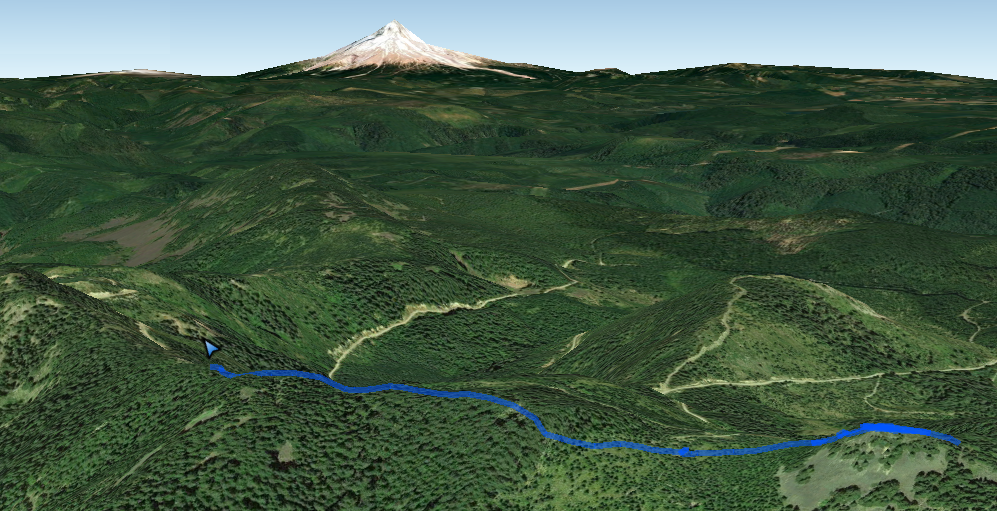
Mount Lowe is the site of a former fire lookout with great views of the Oregon Cascades. It sits on the northern end of the Rhododendron (Rho) Ridge Trail #564. This trail is part of the old Skyline Trail, Oregon's precursor to the Pacific Crest Trail.

Trail Information

Hike Name
Mount Lowe Hike
County & State
Clackamas County, Oregon
Forest
Mt. Hood National Forest
Family Friendliness
Definitely a good jaunt for little ones as long as you stick to the Mount Lowe Hike or the beginnings of the Rho Ridge Traverse Hike.
Hike Difficulty
Easy
Elevation Gain
665 feet
Distance
3.0 miles
Route Type
Out and Back
Access to Trailhead(s)
Follow Hwy 224 south from Estacada for 43 miles to the 4670 forest road. After 8 miles, you can go for the longer hike by taking a right on the 6310 forest road and going one more mile to a saddle in the ridge and park on the right in a pullout. A jeep road is immediately behind and the trailhead is 0.1 miles up that direction.    
Another option (much shorter hike):
Instead of turning right on 6310, keep going on 4670 and cut right on a hairpin turn as you travel below Mount Lowe. This road continues up and provides a little parking area that is a very quick jaunt from a sign indicating Rho Ridge Trail #564 and is only about .25 miles from the top of Mount Lowe. 
1 Comment

Santiam Wagon Road to House Rock

7/15/2017

0 Comments

 
Picture

Fun Trail Facts

The Santiam Wagon Road was one of the dominant routes through the Cascades from 1865 to 1939, joining Sisters to Albany. This mellow hike parallels the South Santiam River.

Start by crossing a gated bridge spanning the South Santiam River and immediately cross into a haunting stand of red alder that transitions into old-growth Douglas firs. Crossing Elk Creek can be a wet chore in rain-drenched months, but not a problem in July. The end point gets you down to House Rock, a two-story boulder known for providing shelter for folks in earlier times. House Rock Falls is nearby, spraying into the South Santiam. House Rock campground is across the river. 

Trail Information

Hike Name
Santiam Wagon Road to House Rock
County & State
Linn County, Oregon
Forest
Willamette National Forest
Family Friendliness
Extremely family friendly.
Hike Difficulty
Easy
Elevation Gain
300 feet
Distance
5 miles
Route Type
Out and Back (Short loop to House Rock and the falls)
Access to Mountain House Trailhead
23.4 miles after Sweet Home if traveling eastward on Highway 20. Keep an eye for a large red building on the left and the parking area will be very nearby on the right.
0 Comments

    Spencer Haley

    I love my kids. I love hiking. This is the intersection.

    Tweets by @Trail_Dad

    RSS Feed

    Categories

    All
    Camping
    Cascades
    Coast Range
    Difficult Hike
    Easy Hike
    Fire Lookout
    Gifford Pinchot National Forest
    Lake
    Moderate Hike
    Mount St. Helens
    Santiam State Forest
    Siuslaw National Forest
    Stream/River
    Tillamook State Forest
    Vista/View
    Volcano
    Waterfall
    Wildflowers
    Willamette Valley

    Archives

    July 2017
    July 2015
    June 2014
    March 2014
    August 2013
    July 2013
    June 2013
    May 2013
    April 2013
    September 2012
    July 2012

    RSS Feed

Powered by Create your own unique website with customizable templates.