Fun Trail Facts
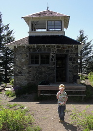
Pechuck Lookout, a historic two-story cupola fire lookout, is listed on the National Historic Lookout Register (actually the second lookout to receive the honor). The lookout, one of the last stone cupolas in the Northwest, was built in 1918 and last staffed in 1964.
Volunteers, the Pechuck Look Outs in Molalla, have done amazing work with the BLM to keep this amazing lookout cared for so that it remains accessible to hikers and backpackers. Nestled in the lovely Table Rock Wilderness (6,028 acres) of the Old Cascades, the lookout is available for overnight stays on a first-come, first-serve basis.
Volunteers, the Pechuck Look Outs in Molalla, have done amazing work with the BLM to keep this amazing lookout cared for so that it remains accessible to hikers and backpackers. Nestled in the lovely Table Rock Wilderness (6,028 acres) of the Old Cascades, the lookout is available for overnight stays on a first-come, first-serve basis.
Trail Info
| Park/Hike/Section Name Pechuck Lookout via Rooster Rock Road Trailhead County & State Clackamas County, Oregon Ecoregion(s) Cascades | Western Cascades Montane Highlands Forest Table Rock Wilderness (Part of the BLM's National Wilderness System) Latitude & Longitude (DEC) 44.9342886, -122.2978583 Family Friendliness Let's just say I either held the lad's hand or had him on my shoulders for 90% of the hike. There are a few spots that are incredibly steep and nervous-making, especially at the summit. Hike Difficulty Difficult Elevation 4,222 feet Elevation Gain 1,580 feet Distance Pechuck Lookout from Rooster Rock Road Trailhead is 5.2 miles. Route Type Out and back Access to Trailhead The Molalla River Corridor is a beautiful, paved drive. Expect about 7 miles of pretty decent gravel roads to reach the Rooster Rock Road Trailhead. |
Trip Report, Part I - Saturday, or the day I lost the trail
Armed with maps, food, and all other essentials, we set forth on Saturday in search of Pechuck Lookout.
Warning: Wrong trail forthcoming.
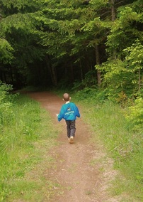
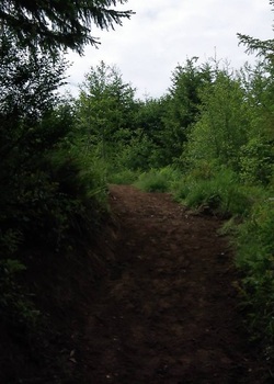
After getting to the Rooster Rock Road Trailhead, we parked the car and gathered our gear up. Looking around, I saw a little embankment near the end of the parking area with a little trail beyond. It looked good, so we started on our way.
With a little bit of incline, things seemed to be jiving with the trail description I had printed out and put in my pocket. Then we needed to cross a stream. Umm, not mentioned in the description. Oh well.
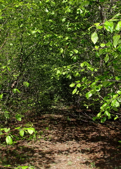
Moving along, we strolled through a beautiful mid-mountain forest, admiring hundreds of butterflies that provided ample opportunities to teach the kiddo all about coloration patterns and what they can mean: camouflage a la' mimesis or warning colorations a la' "don't eat me."
Warning: Wrong trail forthcoming.
After getting to the Rooster Rock Road Trailhead, we parked the car and gathered our gear up. Looking around, I saw a little embankment near the end of the parking area with a little trail beyond. It looked good, so we started on our way.
With a little bit of incline, things seemed to be jiving with the trail description I had printed out and put in my pocket. Then we needed to cross a stream. Umm, not mentioned in the description. Oh well.
Moving along, we strolled through a beautiful mid-mountain forest, admiring hundreds of butterflies that provided ample opportunities to teach the kiddo all about coloration patterns and what they can mean: camouflage a la' mimesis or warning colorations a la' "don't eat me."
Distracted, I checked the description again. Well, we sure weren't climbing 1,000 feet during the first mile of the trek. Checking my GPS, it definitely looked like we were heading in the general direction, but I knew something was awry, compounding the feeling I got immediately after we left the trailhead.
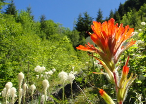
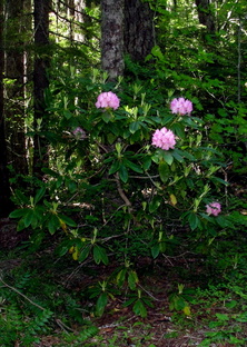
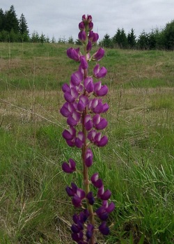
In any case, the trail continued and so did we. After some eventual steep uphill climbing (finally!), we reached a beautiful outcropping halfway up the southern side of the mountain. The rhododendrons, paintbrush, and beargrass were exploding.
The smell! Oh, the smell! The only thing I can liken it to was sticking your nose in a bottle of honey and just inhaling. It was a scent for the ages.
While maintaining the loose trail, we kept forward and just enjoyed the heck out of each stop we could make.
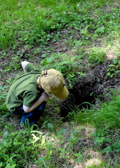
Holes in the ground, complete with double-dog-dares to stick arms within. Neither of us took the other one up on it.
Monstrous banana slugs just aching for company as they slowly moved across a .... leaf.
Oregon flags in full bloom.
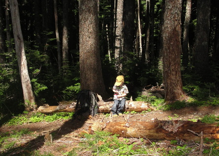
Lunch time was in order, and we broke out the goodies. Prosciutto, sharp cheddar cheese, granola bars, and a few apples delivered the calories.
Holes in the ground, complete with double-dog-dares to stick arms within. Neither of us took the other one up on it.
Monstrous banana slugs just aching for company as they slowly moved across a .... leaf.
Oregon flags in full bloom.
Lunch time was in order, and we broke out the goodies. Prosciutto, sharp cheddar cheese, granola bars, and a few apples delivered the calories.
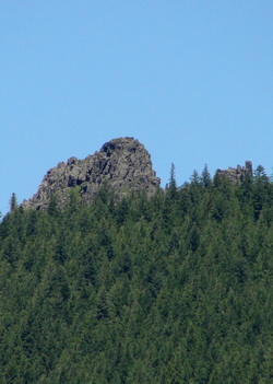
Heading out a bit further, we ran across rocky outcroppings that appeared to be more andesite than basalt. I'm venturing that this was some of the older rocks in the area, especially compared with the basalt that appear to make up Table Rock and Rooster Rock.
Speaking of the latter, I was able to line up where we were on the topographic map with a view of Rooster Rock.
Well, we managed to go over two miles, but down the mountain from our original goal. Conclusion: Way off the original trail, crossing creeks we never should have crossed.
Making our way back, I was a little disheartened by the fact that the boy was disappointed. It was entirely his idea to see Pechcuck Lookout after seeing some amazing pictures and video of the place online. Not making it to the "castle on the mountain" really bummed him out.
I did everything possible to have him appreciate what had been accomplished and enjoyed throughout the day, but I still know it was a downer for him. I figured I would make it up to him during the next weekend or two. We got back to the car at the trailhead, and that was when I noticed the uphill trail that should have been our original destination.
Trip Report, Part II - Sunday, or the day we found Pechuck
Waking up Sunday morning, it was all about appraising what had to be done around the house versus returning to the Table Rock Wilderness so that we could go on the right trail and find Pechuck.
With clearance granted from my lovely wife, the lad and I kissed the ladies of the house goodbye and hit the road again.
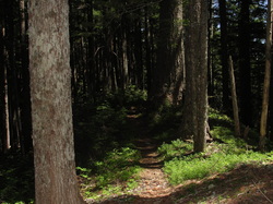
This time, we pulled up to the Rooster Rock Road trailhead and immediately went to the trail so conveniently missed the previous day. Greeted by blooming rhododendrons, mushrooms, and beargrass, the initial part of the trail hid the fact that we would be going vertical for the next mile.
With clearance granted from my lovely wife, the lad and I kissed the ladies of the house goodbye and hit the road again.
This time, we pulled up to the Rooster Rock Road trailhead and immediately went to the trail so conveniently missed the previous day. Greeted by blooming rhododendrons, mushrooms, and beargrass, the initial part of the trail hid the fact that we would be going vertical for the next mile.
I am being dramatic. It was a steep incline, but the trail was soft and the switchbacks were placed perfectly to provide a nice pace during the 1,000' gain in that first mile or so.
I like to have the boy try his hardest to climb stretches of trail, but I did carry him for significant chunks on this one. When it was his turn to hike, there were two significant lessons I have learned with him during elevation gains:
I like to have the boy try his hardest to climb stretches of trail, but I did carry him for significant chunks on this one. When it was his turn to hike, there were two significant lessons I have learned with him during elevation gains:
- He always holds my hand on the side furthest away from any drops.
- Switchbacks uphill make great small "goals" for him to achieve. The reward is a break, a snack, some extra time on my shoulders, some goofing off, or usually a combination of every single one!
After making it to the top of the ridge and turning right (left takes you to Rooster Rock), there was a symphony of trillium and corn iris to meet us, as well as unbelievable views through the trees on either side.
The trail was largely flat for a while, but then dips quite a bit. While a relief after the climb up the mountain, it was definitely a reminder to be ready for coming back!
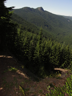
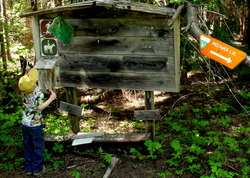
After stumbling across the old trailhead booth near an abandoned road atop the mountain, we started one more steep climb toward Pechuck Lookout. An eerie forest of secondary growth silver fir forest awaits, as does an amazing view of Table Rock near a rock face alongside the trail.
The trail was largely flat for a while, but then dips quite a bit. While a relief after the climb up the mountain, it was definitely a reminder to be ready for coming back!
After stumbling across the old trailhead booth near an abandoned road atop the mountain, we started one more steep climb toward Pechuck Lookout. An eerie forest of secondary growth silver fir forest awaits, as does an amazing view of Table Rock near a rock face alongside the trail.
Upon passing a composting toilet outhouse, we knew we were close! A little more sweat, and we saw the tip of Pechuck peering over the edge, and heard the cries of greetings from a lovely pair of hikers who had passed us on the way up.
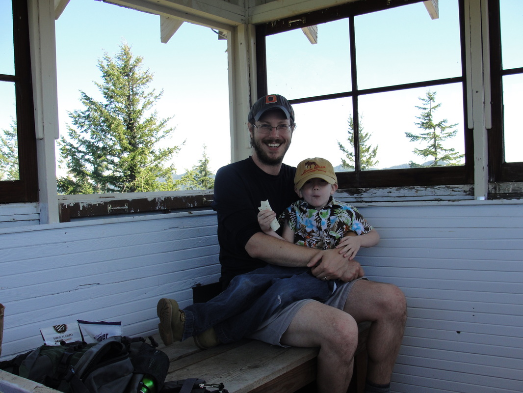
After immediately scoping out the lookout and heading upstairs, it is easy to say that this was worth a day of being on the wrong trail and tackling the tougher correct trail to correct for it.
It isn't only the history of the lookout that bled such neat feelings, but the sense of all folks who had trekked up that way and all of those having camped there. Reading the log book, and scribbling our own entry was in its own way an amazing gesture of camaraderie and a way to break bread with those before and after us.
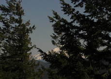
After exploring the lookout for a while longer and enjoying some well-needed calories, we spent a little bit of time scoping out Table Mountain and Mount Jefferson. As the picture to the left shows, it's pretty impressive to see the growth of trees around a historical lookout.
The boy was over the moon about Pechuck Lookout, and we had to go back up to the second story one last time before our departure. I promised him that we would be back one day to stay for an entire evening, but that will have to happen when he is a little more capable of carrying some extra pounds and not residing on my shoulders for 80% of the hike!
Checking the time, we bid the other hikers adieu and headed downward so that my poor wife would not worry too much about our whereabouts. It was a speedy departure on the descent, and a definite reminder of how tough my little guy was on the way up. I was really proud of him for tackling an entire weekend of some pretty good terrain and elevation gain. Pechuck - you are awesome.
More Information
 RSS Feed
