Fun Trail/Park Facts
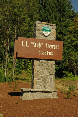
This beautiful Oregon State Park is a bit on the young side, officially opened in July, 2007. Whether your thing is hiking, biking, horses, relaxing, or disc golf, this 1,500+ acre park has got you covered.
As we learned from Ranger Steve (who simply rules), the surrounding forest of Douglas firs is quite young, replanted by human hands during the area's history of logging. Many of the trails are old logging roads, and even their names represent the historical significance of timber in the area.
The park's namesake is Loran LaSells "Stub" Stewart, one of Oregon's most decorated and distinguished citizens. His contributions are amazing: Logging engineer, timber magnate, U.S. army field artillery officer during World War II, major philanthropist (including much support to my alma mater Oregon State University), State Representative, and much, much more.
Trail/Park Info
| Park/Hike/Section Name L.L. "Stub" Stewart State Park; We only did a few hikes, including Matchcutter's Lane, Barberchair Trail, and Bucking Pass. County & State Washington County, Oregon Ecoregion(s) North: Coast Range | Willapa Hills South: Willamette Valley | Valley Foothills Forest Tillamook State Forest Latitude & Longitude (DEC) 45.7369400, -123.1927800 Family Friendliness Seriously folks, it doesn't get any family friendlier than this spot. More than 25 trails, ample camping options, and kids everywhere. Hike Difficulty Easy Elevation 902 Feet Elevation Gain Depends on trails; Doesn't seem to get past 300 feet. Distance Depends on trails; Ranges from 0.16 to 4.23 miles. Exception being the Banks-Vernonia State Trail (21 miles) Route Type Combinations Access to Trailheads/Hikes Ample day-use parking in park, all hikes located throughout the park at various points. For more information, see the official trail guide. |
Trip Report
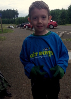
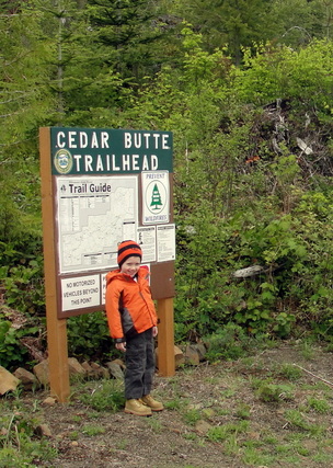
Today was all about National Trails Day at Stub Stewart State Park. The boy and I began the morning bright and early making our way to the park, and upon arrival, eating our breakfast and signing in for a joint trail maintenance venture between Oregon State Parks and REI. We even received some slick volunteer t-shirts with the phrase "Get Dirty" plastered across the front.
After logging many, many miles upon the state's trails over the past couple of years, the timing felt right to show the lad what was behind the magic of every inch of trail we step upon. A refresher for myself was not a bad thing either!
I couldn't have been more thrilled with how things turned out. Our amazing hosts, Rangers Steve and Brandon, were phenomenal and instrumental in getting the most knowledge parlayed into our little group in a short amount of time, including personal and group safety, the lingo behind cutting trails, a breakdown of tools for the job, and the ecology of the park.
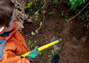
When it was time to throw on the gloves and start maintaining some of the trails around Matchcutter's Lane, we stood at a crossroads around our instrument of choice: Loppers, a Pulaski, a hoe, a McLeod, or a mattock? Considering the boy is still the tender age of four, we went with the responsible choice of a hoe. I think neighboring volunteers breathed a sigh of relief upon seeing our choice.
Ranger Steve provided really solid lessons around drainage concerns, troubles with switchback cutters, the beauty of Oregon soil, forty-five degree backslopes, how to broadcast our organic materials, and more safety tips throughout the exercise. I will never forget the multiple times when the Ranger stomped his foot on the soil for effect, and the lad followed suit and did the same.
After having lots of experiences running into park rangers on the trails or at lookouts, this time it was definitely having an impact on the little guy. Age? Rapport? Definitely both.
The lad was able to experience a little bit of hard work, but mostly got to enjoy the immediate fruits of the labor: bugs and burrows. In the cutest manner, he would ask Range Steve a question each time he came across something new, be it a termite, an ant, or a vole burrow.
While we weren't on that stretch for the longest time, the unspoken camaraderie between volunteers was excellent. Everyone filled in where needed, patching missed points or grooming forgotten pieces of the trail. Soon enough, we ventured down the way and past the intersection of Barberchair Trail. This stretch of trail had some good stumps therein, and we set to work maintaining the areas around the stumps. Naturally, our gear wasn't going to be doing any of the heavy work needed to deal with those bad boys.
Ranger Brandon gave us some insights into how that work would be done, and told us about some of his experiences working on the Banks-Vernonia Trail. I can't wait to do that whole trail, and you can bet I'll be thanking that man throughout it.
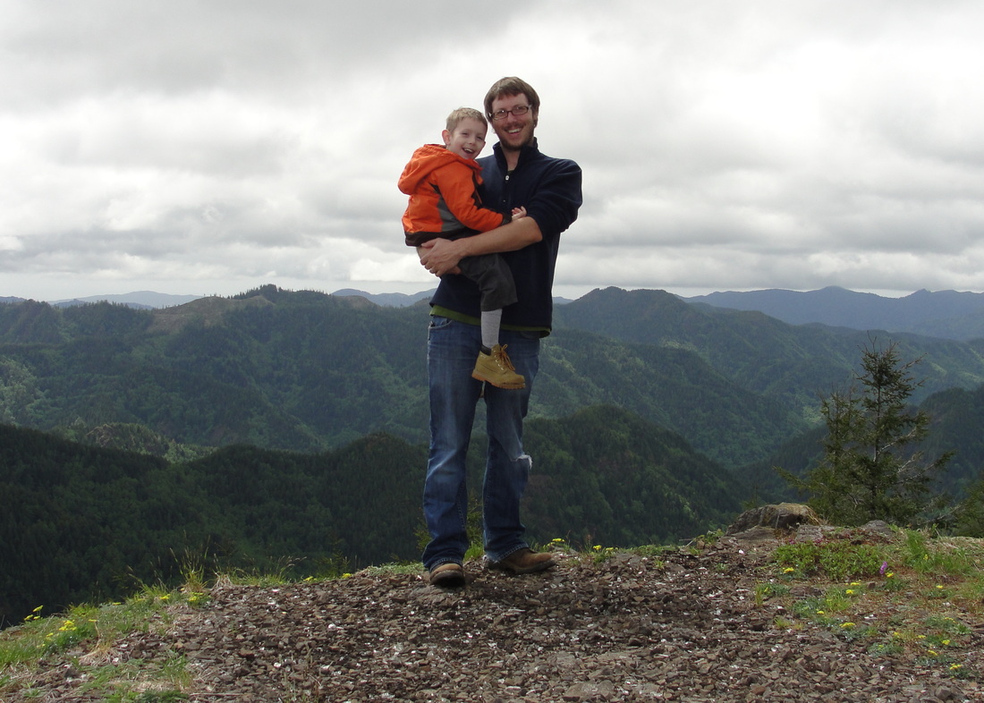
When the time for the activity wrapped up, we hiked back up to the hilltop day-use area and returned our tools (one-at-a-time of course). Pictures were taken and everyone went their own way, preparing for the forthcoming National Trails Day festivities.
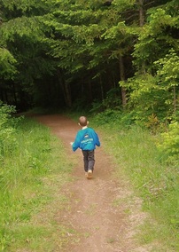
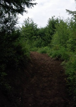
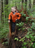
The boy and I grabbed some bites to eat, and made our way through the nearby trails. It is a gorgeous park, and the trails were a blast to traverse, namely because of the varying ages of the surrounding Douglas firs. Some stretches are just a couple of decades old, while others have a little more age amongst them.
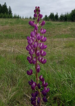
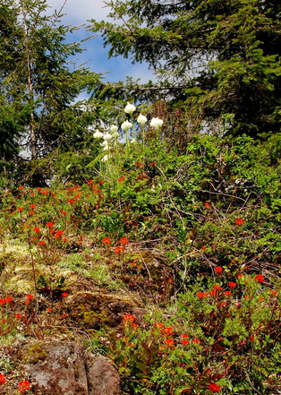
The lupine, in multiple colors, was in full force among the grassy areas, which was a tranquil escape. We passed family after family, which really speaks to the appeal of this area for the little ones.
In a pleasant turn of events, we actually found ourselves returning along the same route that included the areas we had just helped work on. The little guy beamed with some pride when I showed him each area. Score.
The boy and I grabbed some bites to eat, and made our way through the nearby trails. It is a gorgeous park, and the trails were a blast to traverse, namely because of the varying ages of the surrounding Douglas firs. Some stretches are just a couple of decades old, while others have a little more age amongst them.
The lupine, in multiple colors, was in full force among the grassy areas, which was a tranquil escape. We passed family after family, which really speaks to the appeal of this area for the little ones.
In a pleasant turn of events, we actually found ourselves returning along the same route that included the areas we had just helped work on. The little guy beamed with some pride when I showed him each area. Score.
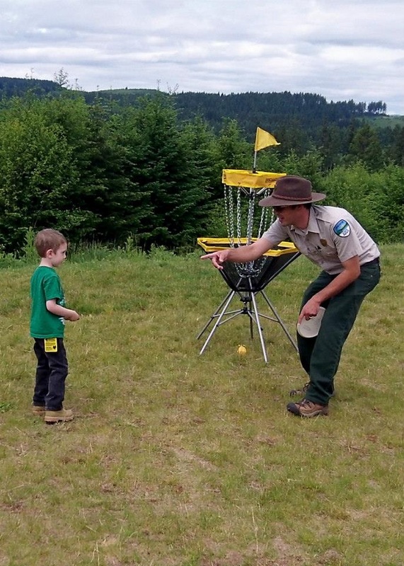
When we finally got back to the picnic area, the festivities were in full effect. The lad cashed in on shwag, namely a carabiner (REI) that now lives on his hiking pack, a water bottle (Equestrian Society), and countless stickers. While he got to observe solar flares courtesy of an OMSI booth, I was able to sink my teeth into some amazing GIS work provided by the Upper and Lower Nehalem Watershed Councils. The blast of activities was rounded out by some disc golf, pelt petting courtesy of Rails to Trails, spore prints by the Oregon Mycological Society, and free sandwiches.
While I was pumped up and ready to continue exploring the park, the poor kiddo had definitely done his share for the day and was ready to head home. As I heavily reflected on the previous week's venture to Marys Peak, it was pretty easy to pack up and plan our return to Stub Stewart for another day.
While we did not get the chance to hit some wild and difficult trails in celebration of National Trails Day, I wouldn't have traded the day at all. It was the lad's first experience with true stewardship in an organized fashion, and the fun he had with the educational outreach programs was top-notch.
I want to thank every single person and organization involved with making our day so amazing. Happy National Trails Day, today and every day hereafter.

 RSS Feed
