Trail Dad - PNW Hikes
  • Home
  • Trip Reports
  • Our Hike Map
  • Outdoor Hacks - Camping | Hiking
  • GIS & Randomness

Cascade Head - Nature Conservancy Trail

7/15/2013

0 Comments

 
Picture

Fun Trail Facts

Picture
Cascade Head was protected from development in the early 1960's, and by 1966, volunteers had raise enough money to purchase the property and transfer it to the Natural Conservancy.

Not only is Cascade Head Preserve a National Scenic Research Area, but it is also considered a United Nations Biosphere Reserve.

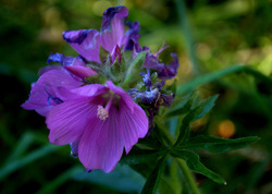
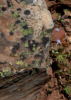
There are some extremely rare organisms that call Cascade Head home. On the plant side, the rare hairy checkermallow and 99% of the world's population of Cascade Head catchfly live here. The threatened Oregon silverspot butterfly finds nourishment for its larvae in the early blue violets that frequent the area, and may be seen fluttering around.

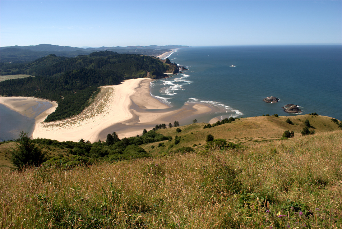
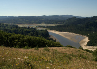
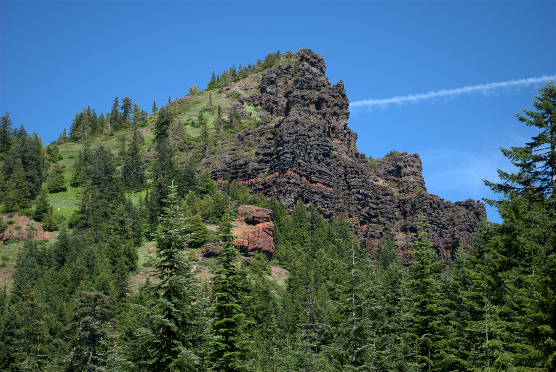
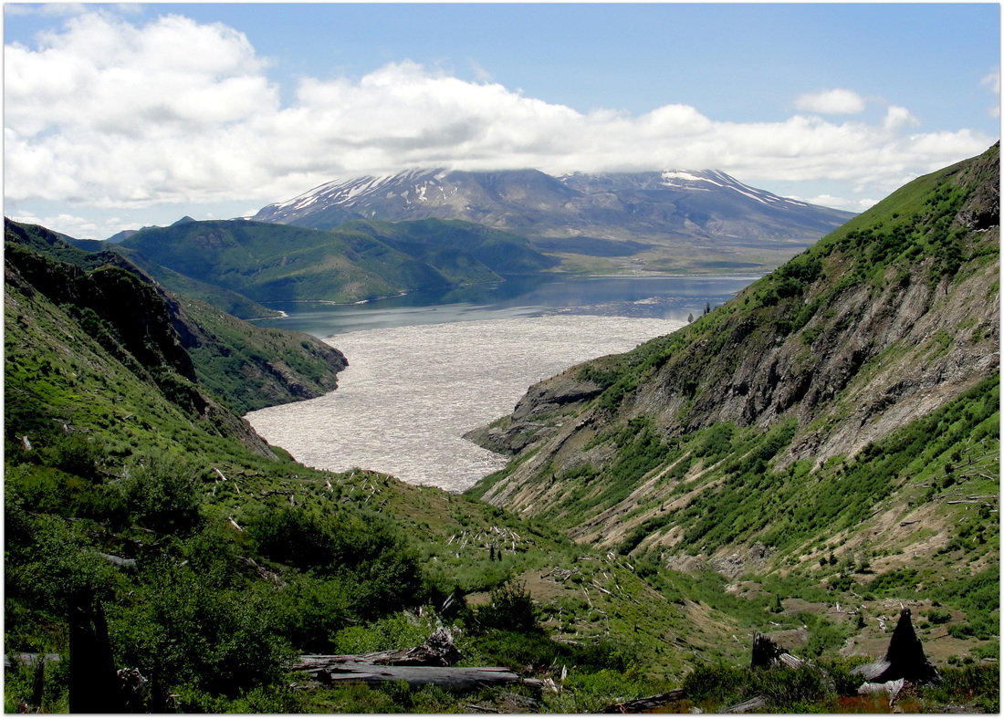
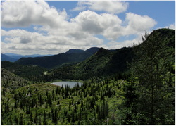
The area is a beautiful combination of different environments, including an estuary (Salmon River), river system, ocean edge, and higher elevation headland and forest.


Trail Information

Hike Name
Cascade Head Nature Conservancy Trail, Lower to Upper Trailhead and Back Again
County & State
Tillamook County, Oregon
Ecoregion
Oregon Coast Range | Coastal Uplands
Forest
Willamette National Forest
Latitude & Longitude (DEC)
45.0567729-124.0048364
Family Friendliness
For the most part, I was very comfortable having my 4-y.o. son with me on this hike. That said, the cliffs at the top are not very far from the trail and they mean business! We're talking hundreds of feet down, and a straight drop at that. The length was a bit rough, and the trail itself is very thin at times with vertically cut edges that can be rough on little legs. These latter concerns would be easily remedied by doing the shorter 1-mile hike from the upper trailhead.
Hike Difficulty
Moderate
Elevation
At the height of the trail, ~ 1,345 feet
Elevation Gain
1,200 feet
Distance
8.4 miles round trip from Knight Park to the Upper Trailhead near Hart's Cove Trail
Route Type
Out and back
Access to Trailhead
Access to Knight Park, site of the lower trailhead, is amazingly easy. There are no dirt or gravel roads to traverse, and it is located just minutes off of Highway 101. See here.
Fee
None. However, there are a couple of donation boxes that help the folks at the Nature Conservancy maintain this place of beauty (hint, hint).
Hiking Notes
This area is so ecologically sensitive, it is really important to stay on the trail and not bring pets.
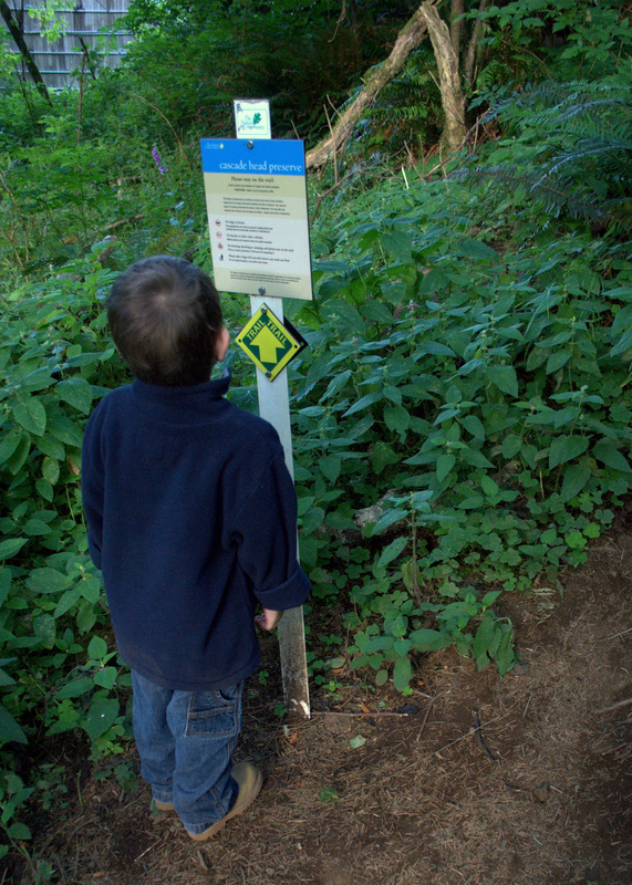
Picture

Trip Report

Picture
My son and I left our house at four in the morning, and his chipper demeanor at such an ungodly hour of being woken up surprised me to no end. While I was struggling to make coffee for the drive, he was bright-eyed and getting dressed. In short order, we were loading the car up and heading toward the Oregon Coast surrounded in darkness.

By the time we reached Knight Park, the sun had just started showing itself, bathing everything in a beautiful glow. We made our way throughout the initial hiking trails, listening to hundreds of birds chattering away. The trail dives a bit into plantation forest, popping up again for a little roadside hugging, and then begins the uphill descent at what appeared to be the original trailhead.

Picture
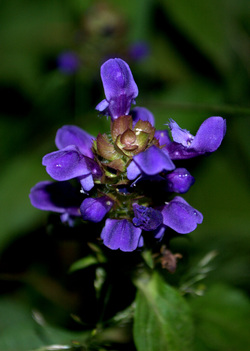
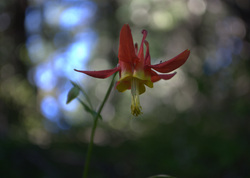
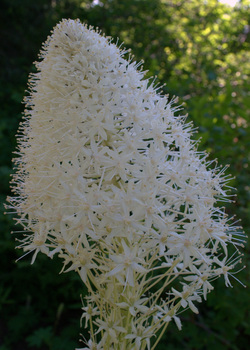
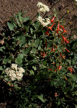
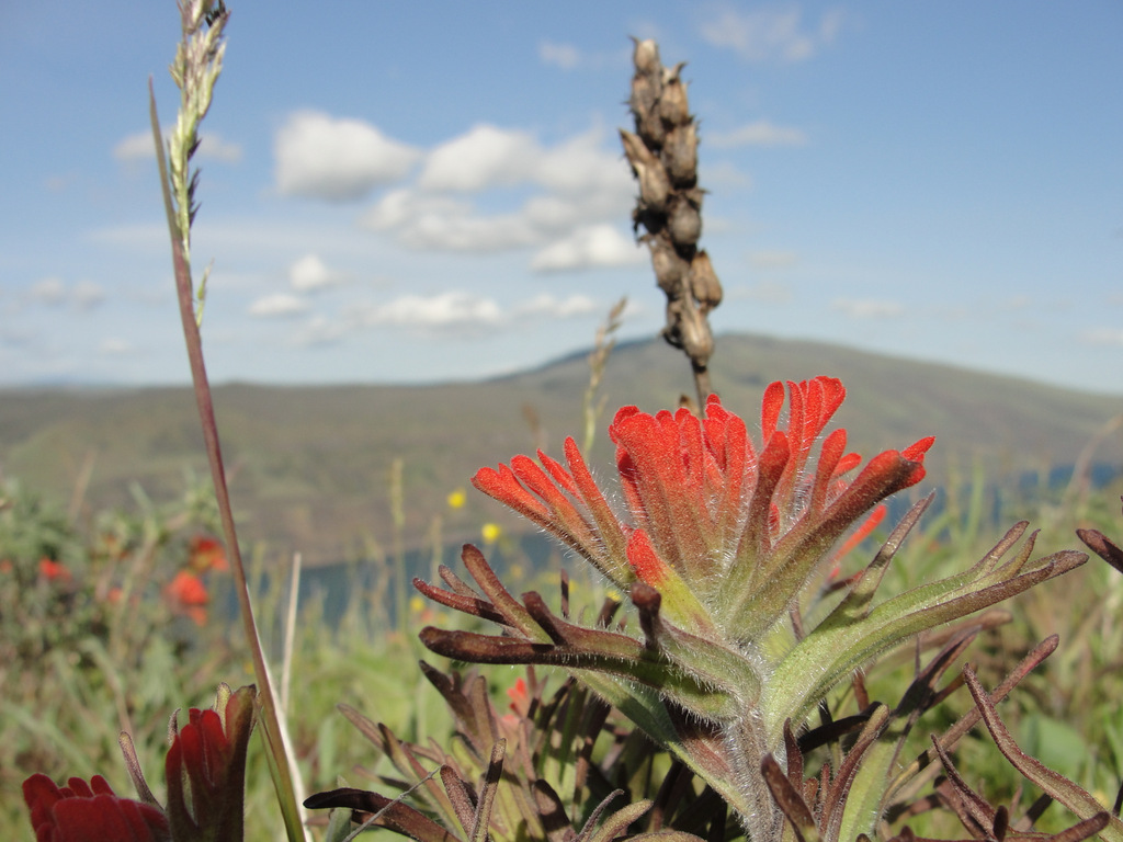
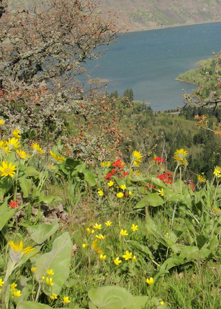
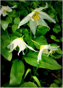
Before much longer, we were feasting on salmonberries and stalking flowers with the camera. The floral varieties were absolutely amazing, and more pictures of them may be found here.

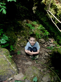
One of the lessons I have solidly acquired during the past couple of years of hiking with my son is that you must always be prepared for ten-, twenty-, or thirty-minute intermissions when a new critter is found. On this hike, he spent the better part of that time observing (and gently petting) a millipede that was crossing the trail. There are fewer things in the world more peaceful than watching his eyes light up with amazement during such bouts of curiosity.

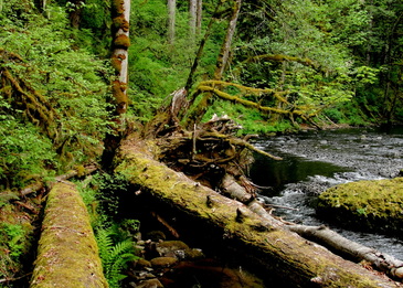
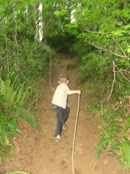
The trail through the forest was heavily root-laden, so do consider your ankles when making your way through the area. There are several very recent-looking bridges that cross streams during this section of the hike.

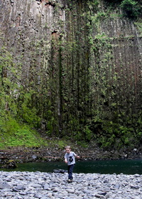
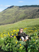
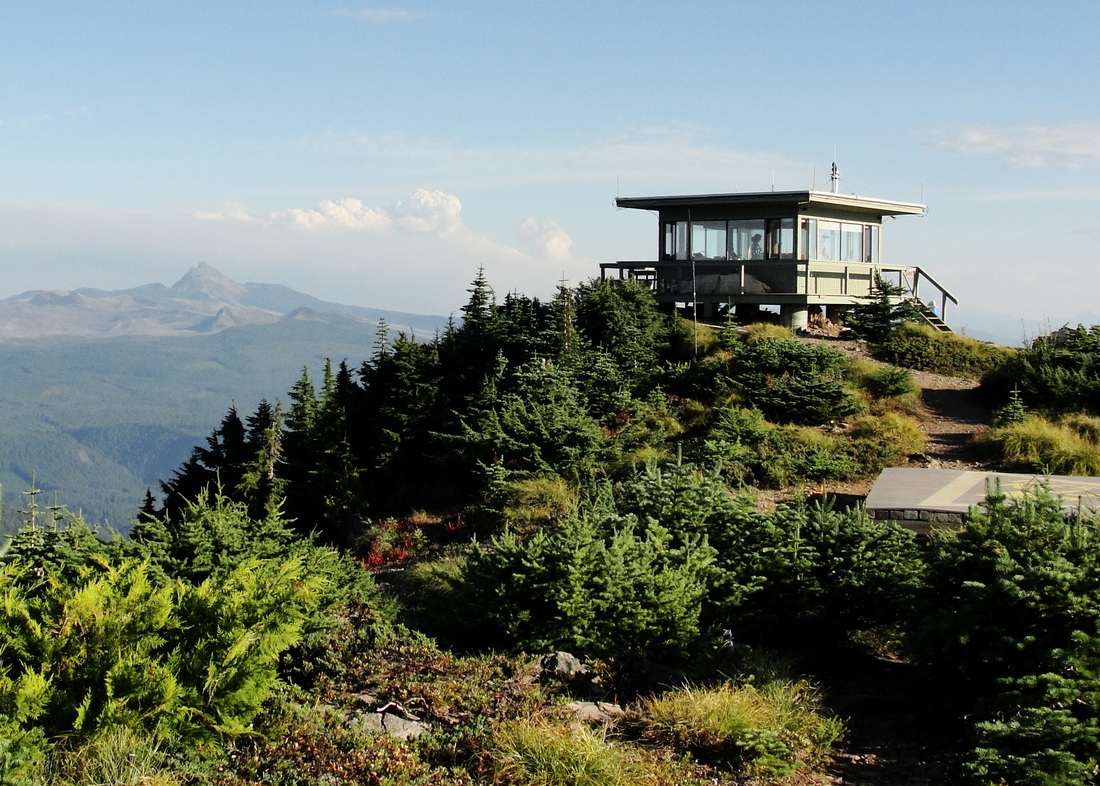
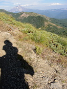
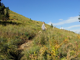
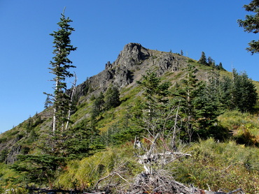
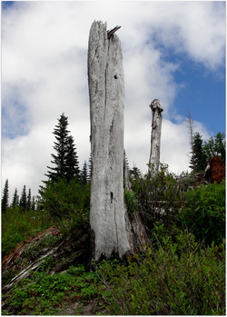
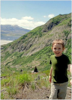
Upon breaking free of the Sitka hemlock, Douglas-fir, and red alder, we came upon our first major ocean views and the absolutely stunning prairie headlands. The trail here is rather thin with some deeply cut edging, so again, keep those ankles safe!

Picture
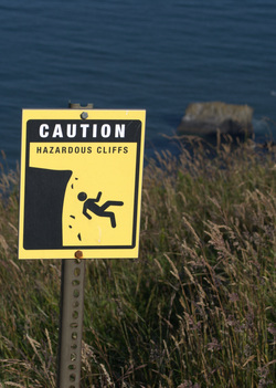
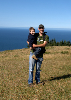
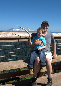
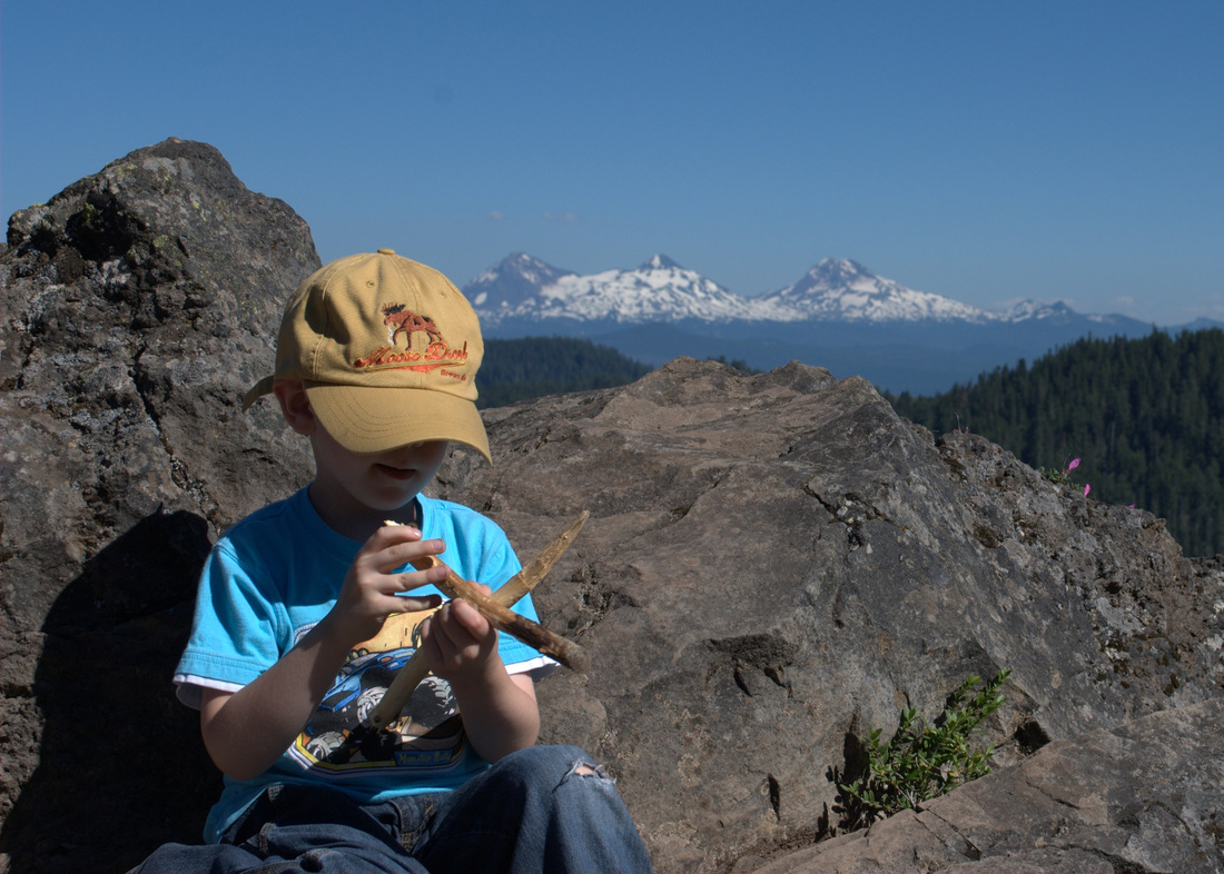
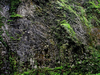
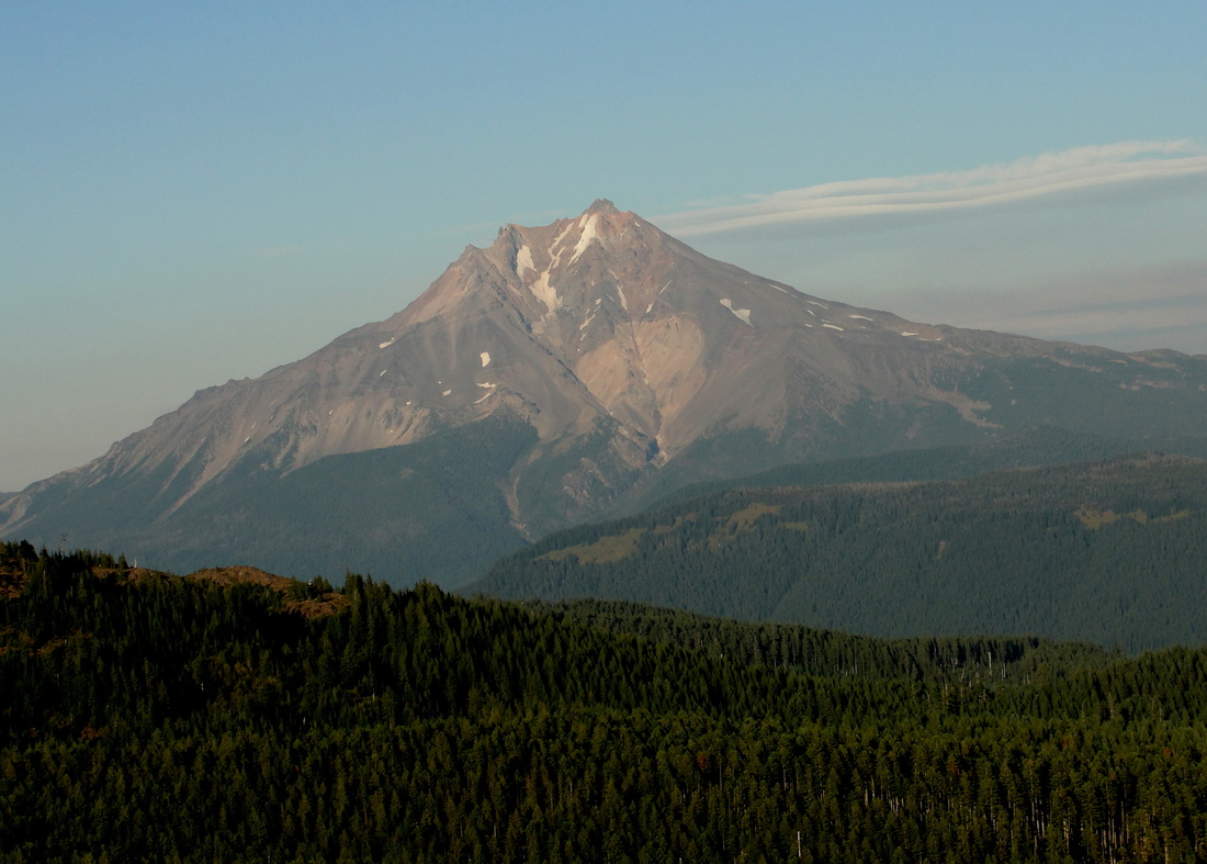
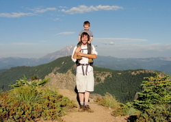
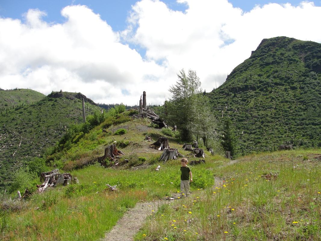
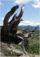
After making our way through several switchbacks, we found ourselves near the summit of the prairie. Nearby cliffs showcase the beauty of the shore below, but the posted warnings are absolutely worthwhile. With gusts of wind periodically kicking up, I can't imagine anyone being of sound mind that would stand close to those edges. I held onto the boy more tightly than usual as we passed the area.

In an interesting twist, we met our first hiker on the trail at this point. He was a really nice guy, who was admiring the boy's appearance out there. Then he dropped the bombshell on us that he has made the hike over 1,600 times! We joked about him knowing every Oregon silver spot butterfly by name, and then went our merry way.

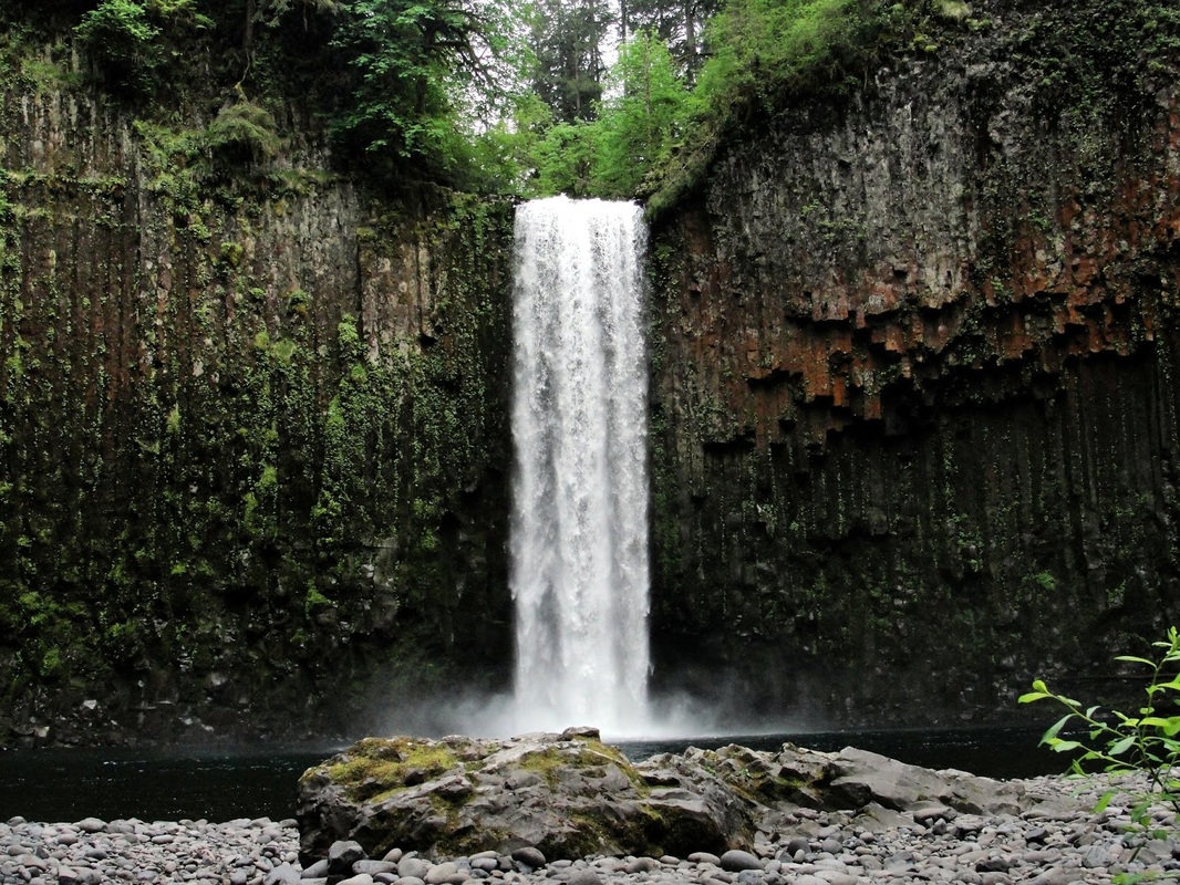
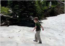
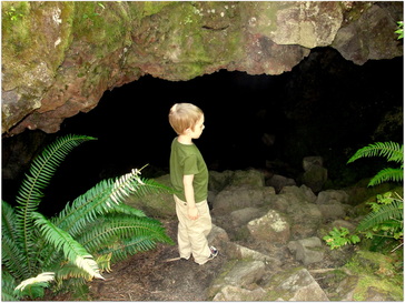
Past the prairie summit and along the north side of the ridge, the trail is immediately swallowed up in forest. Hiking along what seems to be an old road, we made our way through the cool trees and had another ample opportunity to gorge on salmonberries. Within a mile or so, we found ourselves at the Upper trailhead. Signs were posted that no further exploration was allowed until after July 15th, which put us a few days out. We will definitely be back that way to explore Hart's Cove!

I hoisted the boy upon my shoulders and we returned from whence we came. I was absolutely amazed that he was able to hike four miles during this trek, and all of them the uphill portion. I thought that I would surely be carrying him for at least 5 or 6 miles of the hike, but his tenacity broke my assumption. On the way down, we took a few more pictures and spent some extra time gazing out at the ocean as we nibbled on some snacks.

By the time we got back to Knight Park, the masses were descending on the trail. I can't exclaim how happy I was that we got out there at the time we did. It was cool and isolated, allowing us to block the trail to watch millipedes march or garter snakes slither into the grass.

Cascade Head truly is a beautiful place, and reading about the ecosystems and research that comes from the area only heightens my appreciation. The next time I see thinned forests or read about estuary health for anadromous fish, I will be thinking of the natural beauty and science that occurs in that magical area.

More Information

Picture
Cascade Head Preserve in Oregon | The Nature Conservancy

Cascade Head Hike | Portland Hikers

Cascade Head | Wikipedia

Cascade Head Scenic Research Area | Siuslaw National Forest

Cascade Head Experimental Forest | US Forest Service

0 Comments

Iron Mountain

7/6/2013

3 Comments

 
Picture

Fun Trail Facts

Picture
Iron Mountain is 30 million years older than its towering neighbors to the East, and this maturity definitely shows in the varied habitats one encounters hiking to the top. A pamphlet at the trailhead mentions that Iron Mountain is home to 18 different plant communities, ranging from rock, meadow, forest, and water.

The region is often touted as hosting more than 300 species of flowers during the first part of July. 

Trail Info

Hike Name
Iron Mountain Trail #3389
County & State
Linn County, Oregon
Ecoregion
Cascades | Western Cascades Montane Highlands
Forest
Willamette National Forest
Latitude & Longitude (DEC)
44.4009571, -122.1509036
Family Friendliness
With the exception of the cliffs along Iron Mountain's peak, this is one of the friendliest hikes we have been on all season. That said, still one that necessitates a grand amount of hand holding as the elevation gains.
Hike Difficulty
Moderate
Elevation
5,157 feet
Elevation Gain
800 feet
Distance
2.4 miles round trip
Route Type
Out and back
Access to Trailhead
Really easy to reach the upper trailhead, with just a couple of miles of decently worn gravel road going uphill after turning past mile marker 62 on Hwy 20. Multiple trail heads exist depending on what you want to accomplish (Cone Peak Trail; Santiam Wagon Road). See here.
Fee
Northwest Forest Pass

Trip Report

Picture
The claims of 300 species of flowers showing off their wares during the first part of July are no exaggeration. The lad and I lost count at about fifty!

We had big plans a week ago to do some major camping near Iron Mountain, but untimely car troubles (are there any other kind?) sunk that prospect. With some new wheels to get us from Point A to Point B, it was time to initiate the new vehicle with a good trek to the Willamette National Forest.

The trailhead was hopping when we arrived, and excitingly, it was loaded with little hikers. I can't remember the last time I saw so many little legs coming and going on the trail! 

Informative brochures await at the trailhead, as do some pretty great maps of all the hiking trails that intersect Iron Mountain. Major kudos to the Sweet Home Rangers for hooking us up with such material. 

We were running a bit late that day, so we had opted for the shortest hike straight from the Iron Mountain trailhead, but trust me, the lengthier Cone Peak Trail is on the agenda for another time.

Picture
Before departing the trailhead, I asked the boy if he needed to use the facilities. He replied with a negative, and we started uphill. In a moment of parenting truism, he told me that he did indeed need to use the restroom about 300 yards later. 

The U-turn provided some great opportunities to deeply breathe in the blooming beargrass, and when asked why he couldn't just go potty in the woods, I was able to take the moment and explain what a sensitive area was and why stomping through it unnecessarily was never a good idea.

Upon hitting the trail again, we started upward. I am consistently becoming surprised at how strong the little guy is getting; He managed to do the entire trek upward on his own, passing otherwise fit-looking adults who were winded at times. Having a four-year-old cruise past you was sufficient motivation for those couple of folks to keep going!

After a while, the terrain really opens up as you move out of the forest and into the rocky meadows. Every few feet of elevation brought forth more and more floral surprises. The colors, the scents, the butterflies and bees. Combined with switchbacks that framed Mount Jefferson and the Three Sisters, and you  truly have one of the most beautiful spots in Oregon.

Picture
At the summit, an absolutely gorgeous viewing platform awaits, where you can take a rest, grab a bite, and count the peaks all around you. There is even an informative display that points out every hill and mountain viewable from up there.

While eating lunch, the boy and I had a chance to go through some of our pictures and identify flowers based on the informational brochure we picked up at the trailhead:

Baldhip Rose blossom (Rosa gymnocarpa)
Wooly Sunflower (Eriophyllum lanatum)
Oregon, Creamy, and Spreading Stonecrops (Sedum oreganum, oregonense, & divergens)
Scarlet Gilia (Ipomopsis aggregata)
Blue Mountain Larkspur (Delphinium depauperatum)
Crimson columbine (Aquilegia formosa)
Beargrass (Xerophyllux tenax)

This was only a fraction of our pictures, and we still have a lot of identification to perform! 

I played porter for the trip down, with the lad on my shoulders the whole way down. 

In moments that melted my heart (and those of some folks coming up the trail), he was singing an impromptu hiking song all about going the right way or the wrong way when you come to a fork in the trail. It was tough to beat the beauty of the botanical masterpieces all around, but I think he pulled it off.

More Information

Picture
Iron Mountain Trail @ Forest Service

Iron Mountain Hike @ Portland Hikers

Iron Mountain Wildflowers

Wildflowers of the Western Cascades by Robert Ross (Timber Press, 1988)


Picture
3 Comments

Abiqua Falls

5/11/2013

2 Comments

 
Picture

Fun Trail Facts

In 2011, Jesse Coombs successfully kayaked the 96-foot drop at Abiqua Falls. Kids, don't try this at home! Coombs is a professional and still suffered a fractured shoulder socket and a collapsed lung.

Trail Info

Hike/Section Name
Abiqua Falls
County & State
Marion County, Oregon
Ecoregion
Cascades | Western Cascades Montane Highlands
Forest
Santiam State Forest
Latitude & Longitude (DEC)
44.9263208, -122.5672886
Family Friendliness
Really tough, but doable with my 4-year-old
Hike Difficulty
Moderate [some steeper ascents and descents, challenging terrain in parts of the trail]
Elevation
1,264 Feet
Elevation Gain
~200 Feet
Distance
~ 1 Mile
Route Type
Out and Back
Access to Trailhead
Brutally rough gravel road, NOT recommended for passenger cars that you care about

Trip Report

Picture
Abiqua Falls was one of those places that I read about again and again during my research of waterfalls around the Santiam State Forest, and it always left me wanting to make my way there. Noted as a tough place to reach, it wasn't until this past weekend that the boy and I went for it and threw caution to the wind.

With noon approaching on a Saturday afternoon, it was time to scramble and collect our gear. Everything was in order. I just wish the same could have been said for most every other decision I made afterward.

I rarely depend on Google Maps or GPS for directions to trailheads, but for some insane reason I chose this trip to begin with such a folly. The directions landed us on some logged mountainsides' forest roads, and we decided that some some wandering around on the nearby land was in order. According to the GPS, we were 1.3 kilometers away from Abiqua Falls, just on the bloody wrong side of the canyon. Trotting through that much private land and terrain changes has no appeal to me, so we took pictures of our current situation, took a few moments of silence around a roadside memorial, and returned to the car.

Whipping the car back down to Silverton and over to Scotts Mills, we hit a favorite road of ours, Crooked Finger Road, and followed the directions I should have utilized in the first place. After the pavement ended and we took the right at CF300, the road got a little rough as we cruised downhill.

Picture
I read multiple trip reports of people who said that the road down to Abiqua Falls could be traversed by a passenger car.

Well, yes, it could be done. That does not imply it should be done, but we did it anyway. That road truly eats passenger cars for breakfast, as evident by the blown out bits of rubber every half-mile or so. Luckily, we made it safely.

I recalled that you walk back from where you park and cruise down the trail. What I conveniently forgot was the part about ignoring the first trail down and taking the second that was 50-100 feet further down the road.  With the boy on my shoulders, we began traversing our way straight down the mountainside toward Abiqua Creek. The trail all but ended, and we hung tight with the slope. I never felt worried about the lad's safety during our descent, but my legs were nowhere near as accepting.

Picture
At one point, we found a 25-foot clearing that was largely free of rocks and slid down. Remember, I wasn't aware of the second trail at this point and was completely dreading the return up the mountain. "So this is why the hike was listed as not family friendly," I thought to myself, sprinkled with expletives under my breath that nobody but my conscience would hear.

My boy was having a blast throughout all of this. There was only one spot that scared him, and that was when I slipped on a lone rock and drove my knee and elbow into the ground while keeping him stabilized. Despite being shaken up for that brief moment, he was ready to throw rocks into the creek once we were at the water. The moment was taken to wash my wounds and let him skip some stones. A few sips of water, and we were trucking along the creek and heading upstream toward the falls.

Picture
There was absolutely no trail at this point, so we just did our best cruising up and over the fallen trees, boulders, and miscellaneous riparian buffer obstacles. After what felt like a couple thousand feet, we finally hit the actual trail, and it was at this point I noticed the ropes leading back up. My heart sang, and we hadn't even seen the main event. Once we hit the main trail, it was pure fun ducking under or hopping over a couple of trunks.

When you hear the falls just ahead, it does not prepare you for the grandeur that awaits. To turn the corner around the creek and land in the most perfect basaltic amphitheater, with Abiqua Falls crashing down in the center, a sense of absolute wonder overtook both of us. I hooted, he hollered. Hours were spent down there, playing with rocks, talking about basaltic columns, algae and moss, erosion, and a million other things that need to be discussed when you're a four-year-old.

Picture
When it was time to go, we stuck to the proper trail and utilized every inch of rope provided by some kind souls for the trek back up. The lad did great for a bit, but did end up back on my shoulders for a good chunk of the climb. He's getting heavier by the day, but this was one of those spots where I wanted him up there safe and sound.

We got back to my car, and the parking area was as empty when we left as it was when we arrived. After making it back over the hellacious road up the mountain without a flat tire or broken suspension, we enjoyed a beautiful drive through the backroads of the valley.

Even with the botched initial directions, boulder-dodging on the road, and poor trail choice on the way down, I would do this again and again the same way if need be. Abiqua Falls may be one of my absolutely favorite spots in all of Oregon now. Many thanks to the Mount Angel Abbey for letting us enjoy such splendor on their land.

More Information

Northwest Waterfall Survey

Portland Hikers Field Guide

Pudding River Watershed Assessment (2006)
2 Comments

McCall Point

4/20/2013

0 Comments

 
Picture

Fun Trail Facts

Keep your eyes peeled for the interesting topography around Rowena Ridge, which is considered to be the result of earthquake sorting, soil accumulation by plants, critters burrowing, and freezing/thawing cycles. 

McCall Point is named after Thomas Lawson McCall, Oregon's iconic governor from 1967 to 1975.

Trail Info

Hike/Section Name
McCall Point
County & State
Wasco County, Oregon
Ecoregion
Eastern Cascades Slopes and Foothills | Oak/Conifer Foothills
Latitude & Longitude (DEC)
45.6687312, -121.3039614
Family Friendliness
Only if you're holding the wee ones most of the way. The ridge here is no joke, nor is the poison oak or the ticks.
Hike Difficulty
Moderate [not full of steeper ascents and descents, but definitely a workout]
Elevation
1,719 Feet
Elevation Gain
1,070 Feet
Distance
3.6 Miles
Route Type
Out and Back
Access to Trailhead
Very easy access to Rowena Crest Trailhead; No gravel roads.

Trip Report

Picture
Feeling the need for some serious wildflowers, the lad and I embarked on a journey into the Columbia Gorge. Named for former Oregon Governor, Tom McCall, this stunning hike is easily accessible via the Rowena Crest Trailhead.

A note that deserves repeating - I would NOT take young children on this hike unless you are holding them nearly every step of the way. Your companion for good stretches of the trail is a cliff-edge view that goes straight down. For reference, see William Sullivan's graphic of the hike:

Picture
William Sullivan, Oregon.com
Picture
We only ran into one tick, but I also think that we were just a week or so shy of seeing that little bugger population explosion. The poison oak was everywhere immediately off the trail.

With those little caveats out of the way, I have gotta say that this was one of the neatest hikes I have taken with my son. It started a little rough, as the wind that day was appropriately blustery, especially near the trailhead. Once we got going and started gaining elevation, the wildflowers started melting both of our minds. The lad's enthusiasm for the bright colors and pure volume was infectious.

The trail was not crowded at all, and the few folks we passed and met left us with stories for life:

Nigel, who cemented a story about being comfortable in one's own skin.

Susan, who gave us some Ghirardelli for a caloric jolt.

Thank you both.

We only went up to McCall Point and skipped on the second summit further out, which will probably be much more inviting the next time we're up there. For this hike, the views over Rowena Crest and Dell were simply phenomenal.  For mid-April, we were treated to some great weather and lovely wildflowers. Many thanks to the Nature Conservancy, other agency owners, and volunteers for providing such an amazing place.

More Information

Picture
Tom McCall Preserve at Rowena - The Nature Conservancy

Portland Hiker's Field Guide

The Dalles Area Watershed & Council

Hike to McCall Preserve - Oregon.com/William Sullivan

0 Comments

Coffin Mountain

9/15/2012

1 Comment

 
Picture

Fun Trail Facts

When viewed through Blowout Creek from Detroit Lake, Coffin Mountain does indeed look like a coffin fit for a behemoth. Luckily, no giants are waiting for anyone up top. Instead, the occupied lookout atop the mountain is one of six in the Willamette National Forest, and this summit has been the home of at least three other lookout structures since 1905.

Trail Info

Hike/Section Name
Coffin Mountain Trail
County & State
Linn County, Oregon
Ecoregion
Cascades | Western Cascades Montane Highlands
Forest
Willamette National Forest
Latitude & Longitude (DEC)
44.6217884, -122.0442388
Family Friendliness
A great hike with little ones; Caution toward the top.
Hike Difficulty
Moderate [some steeper ascents and descents, challenging terrain in parts of the trail]
Elevation
5,630 Feet
Elevation Gain
1,020 Feet
Distance
3.0 Miles
Route Type
Out and Back
Access to Trailhead
Not bad at all if you follow these directions; Definitely some gravel forest roads, but they were all in good order.

Trip Report

Picture
A staffed lookout sits atop the north side of this coffin-shaped ridge, which gives this mountain its ominous name. This is a glorious hike, and here is part of what nails it:

  • 360 degree views of: Mount Jefferson, 3 Fingered Jack, Mount Washington, Detroit Lake, Broken Top, Three Sisters, Diamond Peak,Mount Rainier, Mount Hood, Mount Adams, and Mount St. Helens.
  • Obscene amounts of bear poop.
  • Constant changes to the environment.

Picture
The hike up to the top of Coffin Mountain is a lovely trip through grassy slopes and snags.

Starting on a logging track, you make your way through an obviously old clearcut and move along the south ridge of the mountain.

An open meadow awaits, as do several really lengthy switchbacks. Eventually, you hit some alpine forest and really start gaining some visuals on the lookout, and some truly impressive outcroppings.

Picture
Picture
Once we made our way to the very top, the ranger who staffs the lookout came out and and met us near the helicopter pad. She was telling us all about the fires that were causing the haziness along the skyline,
and then mentioned that she rarely ever sees children up there as young as my wee one. That said, I think she was ready for him, because she gave him a Smoky the Bear bookmark and ranger sticker. So. Awesome.

Being September, we missed the rhododendrons and beargrass. The ranger mentioned that coming back in June or July would be the ticket on that front. She also recommended Bachelor Mountain, just up the road.

All told, this was an extremely approachable climb with the little guy holding my hand and up on my shoulders. The constantly changing landscape was unlike most of our hikes, and I think that may have worn him out a bit! One of his favorite parts was chasing the grouse around, and his inner detective came out when it came to identifying bear poop based on the berry contents. Good life skills!!!

It was a lonely hike that afternoon. Not a single soul parked at the trailhead, nor did we pass anyone.

More Information

Picture
SummitPost.org

Forest Service - Coffin Mountain Trail Area

1 Comment

Norway Pass & Lava Tubes

7/21/2012

0 Comments

 
Picture

Fun Trail Facts

Picture
Right after the eruption of Mount St. Helens, local newspapers reported that Spirit Lake (pictured above) had all but disappeared, as it appeared indistinguishable from the Dante-esque landscape in the Blast Zone on the south facing slopes of the mountain. In reality, it was just camouflaged underneath the felled forest and volcanic debris that was floating on its surface. While it is a gorgeous blue lake now, an ever-present reminder of the eruption over thirty years ago remains; A ghostly layer of floating trees remains on part of its surface, giving the impression of ice when first glanced upon.

No fish were found in Spirit Lake until 1993, 13 years after the eruption. Recent population counts have shown expansion in both abundance and growth rates.


Trail Info

Hike/Section Name
Boundary Trail #1 Norway Pass TH to Norway Pass
County & State
Skamania County, Washington
Ecoregion
Cascades | Western Cascades Montane Highlands
Forest
Gifford Pinchot National Forest
Latitude & Longitude (DEC)
46.3101110, -122.1056504
Family Friendliness
Tough hike for Dad the pack mule, but a pretty phenomenal hike for the little guy. Rarely was I nervous about the lad hiking by himself next to me. 
Hike Difficulty
Moderate [lengthy with some decent elevation gain]
Elevation
4,518 Feet
Elevation Gain
873 Feet
Distance
4.5 Miles
Route Type
Out and Back
Access to Trailhead (Link)
A breeze. After taking Forest Road 26 from NF-99, you come right up on the parking for the trailhead. 

Trip Report

Picture
Taking the Boundary Trail from the Norway Pass Trailhead up to Norway Pass was an amazing journey for us. The drive alone was awe-inspiring, watching the landscape change from beautiful Cascade forest into a rugged and desolate terrain, where the skeletons of scorched trees still point upward at the sky. 

The trip up to Norway Pass is situated right in the middle of this zone, but the thirty-plus years since the eruption have softened the absolute destruction. Nearby Meta Lake and the wildflowers everywhere provide a welcome contrast to the pumice-laden and barren stretches that hint at what was the rule of the area rather than the exception.

Picture
Speaking of barren, this hike was a dry and dusty journey. Really, really, really dusty. 

I should know better than to think such things, but every time we got ash and dust on us, I kept thinking about how we were inhaling fragments of pulverized rock, minerals, and volcanic glass.

Being late July, it was a sweltering journey at times as well. Until we hit the snow. More on that later. 

For those reasons, I highly recommend that you start this trek early in the day and definitely take more water than you think you'll need. I'm usually in the position of constantly offering my son water to make sure he stays hydrated during such trips, but this was one journey that he needed no extra prodding.

FYI - There is a fantastic water pump at the trail head.

Picture
Picture
Once you get some elevation (which happens quickly during the first mile), Meta Lake becomes very visible from your dusty perch. Amazingly, this 9-acre lake that was in the blow down zone maintained its circle of life after the eruption, as self-reproducing Eastern Brook trout survived the blast and thrived afterward without much competition. I have to imagine the snow helped. Now you can see lushness all around, as reeds and grass share the nearby shore with hemlock and Douglas firs.

While standing there thinking about how nice a dip would be in such water, I realized that it was getting warmer and that we still had a long way to go. With that in mind, the two of us continued cruising up in elevation, watching the subtle changes in scenery, and getting the opportunities to really learn from one of the greatest geological and ecological laboratories in the region. Primary, secondary, and tertiary succession were really easy concepts to teach the lad on this hike, as examples were everywhere.

Picture
Being late July, it had been months since we had thought of snow. Much to my happiness, and definitely to that of the lad's, we came across a beautiful patch of the white stuff that was slowly melting. After testing the depth, I let the boy go to town.

While he played, I soaked my hat in some melted snow and was never so happy to have such chilliness flow down the back of my neck. It was a really welcome break, and his giddiness was contagious. Needless to say, snowball fights ensued.

Picture
Once we left our little winter wonderland, we climbed up the elevation a bit more and were treated to some amazing flowers. Penstemon, bear grass, lupine, paintbrush, and foxglove all called out to us. Douglas fir and mountain hemlock are starting to grow quite nicely, mixed together with blasted tree trunks. Hummingbirds and bees were feasting.

It was just awe-inspiring, knowing that before the recovery, the soil had practically been blasted down to the bedrock. Thanks to some fierce competition between some ornery species, the beauty of the forest is returning.


Picture
Upon reaching Norway Pass, we took it upon ourselves to feast and explore a rough path that went just a little bit down toward Spirit Lake. The Independence Trail was closed, and we sure weren't making the trek to Mt. Margaret (that day...), so we got to just sit back and watch the cloud-covered giant of a volcano in the distance.

After pulling out the binoculars, we managed to catch some great views of the high-water mark around the lake that was left by the devastation from the summit of Mt. Saint Helens sliding into Spirit Lake three decades back. Apparently, the water was pushed up 800 feet during the event.

After some goofing around and quiet reflection on everything that we had seen thus far, we turned around and headed down. We got to play some more in the snow and really get some new vantage points of things we had missed on the way up - Mt. Rainier, a gorgeous nearby waterfall, and way too many chipmunks.

My favorite part on the way down was winning a bet with the boy around the fact that I could make a rock float. When he saw pumice do its thing, he was as giddy as I remember being the first time I ever saw it bobbing on top of water. I should have bet him $5, but instead it was just a friendly bet without a wager.

Picture
While driving toward the southern end of the volcano, we had to stop by the Trail of Two Forests Interpretive Site. We didn't have enough time to make our way through the Ape Caves, but this really worked out. Not only do you truly get to see two different forests split in the middle, but there are amazing tree molds that remain in the lava beds. There are very kid-friendly tree casts, and the boardwalk through the trail provides a really casual experience.

Of course, we had to take the trail away from the boardwalk and go find some bigger caves that did not have any bats hanging out. We found plenty along the slight trails, just about half of a mile away from the Interpretive Site itself.

On the way home, I found myself promising the boy that we would be back. Next time, it'll just be further up to Mt. Margaret and all the way into the Ape Caves.

More Information

Picture
Norway Pass - Washington Trails Association

Boundary Trail #1 Norway Pass TH to Norway Pass - Forest Service

Road Guide to Mt St. Helens National Park

The Narrative Image: A Million Pictures of the Same Thing: Mt. Margaret Hike via Norway Pass Trailhead

0 Comments

    Spencer Haley

    I love my kids. I love hiking. This is the intersection.

    Tweets by @Trail_Dad

    RSS Feed

    Categories

    All
    Camping
    Cascades
    Coast Range
    Difficult Hike
    Easy Hike
    Fire Lookout
    Gifford Pinchot National Forest
    Lake
    Moderate Hike
    Mount St. Helens
    Santiam State Forest
    Siuslaw National Forest
    Stream/River
    Tillamook State Forest
    Vista/View
    Volcano
    Waterfall
    Wildflowers
    Willamette Valley

    Archives

    July 2017
    July 2015
    June 2014
    March 2014
    August 2013
    July 2013
    June 2013
    May 2013
    April 2013
    September 2012
    July 2012

    RSS Feed

Powered by Create your own unique website with customizable templates.